Area Overview for TW5 9BE
Photos of TW5 9BE
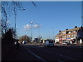
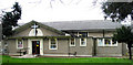
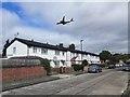
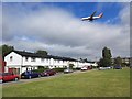
48 photos from this area
Area Information
Key information about the TW5 9BE including its size, population, and administrative classification.
- Area Type
- Postcode
- Area Size
- 1.3 hectares
- Population
- 2122
- Population Density
- 10119 people/km²
House Prices in TW5 9BE
39
Properties
£326,650
Average Sold Price
£71,000
Lowest Price
£730,000
Highest Price
Showing 39 properties
| Address | Type | Beds | Baths | Last Sale Price | Last Sale Date | |
|---|---|---|---|---|---|---|
| 2 Browning Way, Hounslow, TW5 9BE | Semi-detached | 3 | 1 | £730,000 | Sep 2023 | |
| 46 Browning Way, Hounslow, TW5 9BE | Semi-detached | 3 | 2 | £586,000 | Oct 2022 | |
| 20 Browning Way, Hounslow, TW5 9BE | Retail | 3 | 1 | £460,000 | Feb 2022 | |
| 42 Browning Way, Hounslow, TW5 9BE | Semi-detached | 3 | - | £580,000 | Dec 2020 | |
| 6 Browning Way, Hounslow, TW5 9BE | Semi-detached | 3 | 1 | £495,000 | Jan 2019 | |
| 72 Browning Way, Hounslow, TW5 9BE | Semi-detached | 5 | 1 | £537,000 | May 2016 | |
| 14 Browning Way, Hounslow, TW5 9BE | house | - | - | £320,000 | Feb 2014 | |
| 70 Browning Way, Hounslow, TW5 9BE | house | - | - | £302,500 | Apr 2012 | |
| 30 Browning Way, Hounslow, TW5 9BE | house | - | - | £297,000 | Dec 2011 | |
| 56 Browning Way, Hounslow, TW5 9BE | Semi-detached | - | - | £285,000 | Apr 2007 |
Page 1 of 4
Energy Efficiency in TW5 9BE
Amenities
Schools
| Rank | School | Type | Entry gender | Ages |
|---|
Explore more schools in this area
Go to Schools tabDemographics
Household Size
Family (3-5 people)
most common
Accommodation Type
Houses
most common
Tenure
60
majority
Ethnic Group
asian_total
most common
Religion
N/A
most common
Household Composition
N/A
most common
Age
47
median
Adults (30-64 years)
most common
Household Deprivation
N/A
with no deprivation
NS-SEC
24
in Lower managerial occupations
Explore more demographic insights in this area
Go to Demographics tabPlanning
Planning Constraints
- Flood RiskPremium
- Ramsar Wetland SitesPremium
- Area of Outstanding Natural BeautyPremium
- Protected Nature ReservePremium
- Protected WoodlandPremium