Area Overview for TW5 9BD
Photos of TW5 9BD
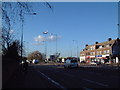
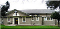
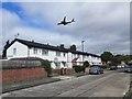
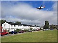
48 photos from this area
Area Information
Key information about the TW5 9BD including its size, population, and administrative classification.
- Area Type
- Postcode
- Area Size
- 7175 m²
- Population
- 2001
- Population Density
- 3773 people/km²
House Prices in TW5 9BD
12
Properties
£487,333
Average Sold Price
£115,000
Lowest Price
£985,000
Highest Price
Showing 12 properties
| Address | Type | Beds | Baths | Last Sale Price | Last Sale Date | |
|---|---|---|---|---|---|---|
| 59 Burns Way, Hounslow, TW5 9BD | house | - | - | £985,000 | Nov 2024 | |
| 69 Burns Way, Hounslow, TW5 9BD | Semi-detached | 5 | 2 | £830,000 | Jan 2023 | |
| 71 Burns Way, Hounslow, TW5 9BD | Terraced | - | - | £385,000 | Aug 2008 | |
| 65 Burns Way, Hounslow, TW5 9BD | Semi-detached | - | - | £390,000 | Nov 2003 | |
| 55 Burns Way, Hounslow, TW5 9BD | Semi-detached | 1 | 2 | £219,000 | Jul 2001 | |
| 75 Burns Way, Hounslow, TW5 9BD | Semi-detached | - | - | £115,000 | Oct 1995 | |
| 61 Burns Way, Hounslow, TW5 9BD | Semi-detached | 2 | 1 | - | - | |
| 57 Burns Way, Hounslow, TW5 9BD | Semi-detached | - | - | - | - | |
| 67 Burns Way, Hounslow, TW5 9BD | Terraced | - | - | - | - | |
| 63 Burns Way, Hounslow, TW5 9BD | Semi-detached | - | - | - | - |
Page 1 of 2
Energy Efficiency in TW5 9BD
Amenities
Schools
| Rank | School | Type | Entry gender | Ages |
|---|
Explore more schools in this area
Go to Schools tabDemographics
Household Size
Family (3-5 people)
most common
Accommodation Type
Houses
most common
Tenure
54
majority
Ethnic Group
asian_total
most common
Religion
N/A
most common
Household Composition
N/A
most common
Age
47
median
Adults (30-64 years)
most common
Household Deprivation
N/A
with no deprivation
NS-SEC
24
in Lower managerial occupations
Explore more demographic insights in this area
Go to Demographics tabPlanning
Planning Constraints
- Flood RiskPremium
- Ramsar Wetland SitesPremium
- Area of Outstanding Natural BeautyPremium
- Protected Nature ReservePremium
- Protected WoodlandPremium