Area Overview for TW5 0JD
Photos of TW5 0JD
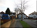
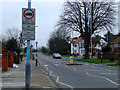
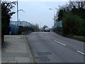

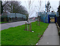
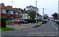
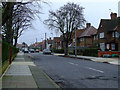
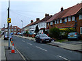
68 photos from this area
Area Information
Key information about the TW5 0JD including its size, population, and administrative classification.
- Area Type
- Postcode
- Area Size
- 1.3 hectares
- Population
- 2060
- Population Density
- 8937 people/km²
House Prices in TW5 0JD
38
Properties
£355,873
Average Sold Price
£93,000
Lowest Price
£710,000
Highest Price
Showing 38 properties
| Address | Type | Beds | Baths | Last Sale Price | Last Sale Date | |
|---|---|---|---|---|---|---|
| 25 West Way, Hounslow, TW5 0JD | Semi-detached | 4 | 3 | £710,000 | Sep 2025 | |
| 9 West Way, Hounslow, TW5 0JD | Semi-detached | 3 | 1 | £635,000 | May 2023 | |
| 13 West Way, Hounslow, TW5 0JD | house | - | - | £650,000 | Jun 2021 | |
| 71 West Way, Hounslow, TW5 0JD | Semi-detached | 4 | 3 | £595,000 | Apr 2021 | |
| 55 West Way, Hounslow, TW5 0JD | Semi-detached | 3 | - | £470,000 | Nov 2018 | |
| 67 West Way, Hounslow, TW5 0JD | Semi-detached | 3 | - | £460,000 | Oct 2017 | |
| 65 West Way, Hounslow, TW5 0JD | Semi-detached | 3 | 1 | £545,500 | Aug 2017 | |
| 27 West Way, Hounslow, TW5 0JD | Semi-detached | 3 | 1 | £340,000 | Nov 2013 | |
| 53 West Way, Hounslow, TW5 0JD | Semi-detached | - | - | £304,500 | Jul 2012 | |
| 47 West Way, Hounslow, TW5 0JD | house | 3 | - | £292,000 | Mar 2012 |
Page 1 of 4
Energy Efficiency in TW5 0JD
Amenities
Schools
| Rank | School | Type | Entry gender | Ages |
|---|
Explore more schools in this area
Go to Schools tabDemographics
Household Size
Family (3-5 people)
most common
Accommodation Type
Houses
most common
Tenure
72
majority
Ethnic Group
asian_total
most common
Religion
N/A
most common
Household Composition
N/A
most common
Age
47
median
Adults (30-64 years)
most common
Household Deprivation
N/A
with no deprivation
NS-SEC
27
in Lower managerial occupations
Explore more demographic insights in this area
Go to Demographics tabPlanning
Planning Constraints
- Flood RiskPremium
- Ramsar Wetland SitesPremium
- Area of Outstanding Natural BeautyPremium
- Protected Nature ReservePremium
- Protected WoodlandPremium