Area Overview for TW4 5JP
Photos of TW4 5JP
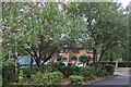
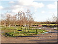
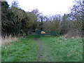
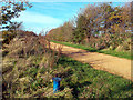
28 photos from this area
Area Information
Key information about the TW4 5JP including its size, population, and administrative classification.
- Area Type
- Postcode
- Area Size
- 4613 m²
- Population
- 1909
- Population Density
- 14573 people/km²
House Prices in TW4 5JP
45
Properties
£260,833
Average Sold Price
£128,000
Lowest Price
£420,000
Highest Price
Showing 45 properties
| Address | Type | Beds | Baths | Last Sale Price | Last Sale Date | |
|---|---|---|---|---|---|---|
| 236 Wellington Road South, Hounslow, TW4 5JP | Semi-detached | 4 | 2 | £420,000 | Jul 2024 | |
| 242 Wellington Road South, Hounslow, TW4 5JP | Maisonette | 2 | 1 | £207,000 | May 2014 | |
| 244A Wellington Road South, Hounslow, TW4 5JP | Flat | - | - | £230,000 | Feb 2010 | |
| 248A Wellington Road South, Hounslow, TW4 5JP | Flat | 4 | 2 | £375,000 | Jul 2006 | |
| 270 Wellington Road South, Hounslow, TW4 5JP | Terraced | 3 | 2 | £205,000 | Mar 2003 | |
| 264 Wellington Road South, Hounslow, TW4 5JP | Terraced | - | - | £128,000 | Oct 1999 | |
| 252A Wellington Road South, Hounslow, TW4 5JP | Retail | 1 | 1 | - | - | |
| 256 Wellington Road South, Hounslow, TW4 5JP | Flat | 4 | 2 | - | - | |
| 238 Wellington Road South, Hounslow, TW4 5JP | Semi-detached | - | - | - | - | |
| 260 Wellington Road South, Hounslow, TW4 5JP | Unknown | - | - | - | - |
Page 1 of 5
Energy Efficiency in TW4 5JP
Amenities
Schools
| Rank | School | Type | Entry gender | Ages |
|---|
Explore more schools in this area
Go to Schools tabDemographics
Household Size
Family (3-5 people)
most common
Accommodation Type
Houses
most common
Tenure
45
majority
Ethnic Group
asian_total
most common
Religion
N/A
most common
Household Composition
N/A
most common
Age
47
median
Adults (30-64 years)
most common
Household Deprivation
N/A
with no deprivation
NS-SEC
21
in Lower managerial occupations
Explore more demographic insights in this area
Go to Demographics tabPlanning
Planning Constraints
- Flood RiskPremium
- Ramsar Wetland SitesPremium
- Area of Outstanding Natural BeautyPremium
- Protected Nature ReservePremium
- Protected WoodlandPremium