Area Overview for TW14 9LJ
Photos of TW14 9LJ
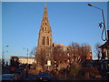
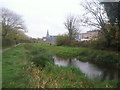
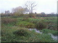
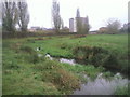
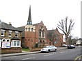
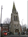
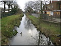
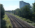
86 photos from this area
Area Information
Key information about the TW14 9LJ including its size, population, and administrative classification.
- Area Type
- Postcode
- Area Size
- 1.3 hectares
- Population
- 2263
- Population Density
- 5091 people/km²
House Prices in TW14 9LJ
42
Properties
£254,690
Average Sold Price
£55,000
Lowest Price
£490,000
Highest Price
Showing 42 properties
| Address | Type | Beds | Baths | Last Sale Price | Last Sale Date | |
|---|---|---|---|---|---|---|
| 71 Gladstone Avenue, Feltham, TW14 9LJ | Semi-detached | 3 | 1 | £490,000 | Jul 2023 | |
| 19 Gladstone Avenue, Feltham, TW14 9LJ | Semi-detached | 3 | - | £360,000 | Jun 2018 | |
| 75 Gladstone Avenue, Feltham, TW14 9LJ | Semi-detached | 3 | 1 | £376,000 | May 2018 | |
| 27 Gladstone Avenue, Feltham, TW14 9LJ | Semi-detached | 3 | 1 | £385,000 | Mar 2018 | |
| 57 Gladstone Avenue, Feltham, TW14 9LJ | house | - | - | £440,000 | Jun 2017 | |
| 37 Gladstone Avenue, Feltham, TW14 9LJ | Terraced | 3 | 1 | £404,000 | Sep 2016 | |
| 51 Gladstone Avenue, Feltham, TW14 9LJ | Semi-detached | 3 | 1 | £337,500 | Sep 2014 | |
| 45 Gladstone Avenue, Feltham, TW14 9LJ | house | - | - | £250,000 | Jun 2013 | |
| 63 Gladstone Avenue, Feltham, TW14 9LJ | house | - | - | £230,000 | Dec 2012 | |
| 61 Gladstone Avenue, Feltham, TW14 9LJ | house | - | - | £250,000 | Oct 2012 |
Page 1 of 5
Energy Efficiency in TW14 9LJ
Amenities
Schools
| Rank | School | Type | Entry gender | Ages |
|---|
Explore more schools in this area
Go to Schools tabDemographics
Household Size
Family (3-5 people)
most common
Accommodation Type
Houses
most common
Tenure
60
majority
Ethnic Group
White
most common
Religion
N/A
most common
Household Composition
N/A
most common
Age
47
median
Adults (30-64 years)
most common
Household Deprivation
N/A
with no deprivation
NS-SEC
23
in Lower managerial occupations
Explore more demographic insights in this area
Go to Demographics tabPlanning
Planning Constraints
- Flood RiskPremium
- Ramsar Wetland SitesPremium
- Area of Outstanding Natural BeautyPremium
- Protected Nature ReservePremium
- Protected WoodlandPremium