Area Overview for TW14 9LB
Photos of TW14 9LB
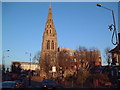
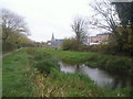
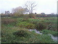
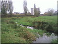
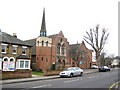
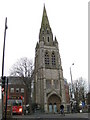
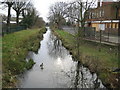
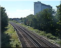
86 photos from this area
Area Information
Key information about the TW14 9LB including its size, population, and administrative classification.
- Area Type
- Postcode
- Area Size
- 1.9 hectares
- Population
- 2263
- Population Density
- 5091 people/km²
House Prices in TW14 9LB
20
Properties
£276,838
Average Sold Price
£60,000
Lowest Price
£540,000
Highest Price
Showing 20 properties
| Address | Type | Beds | Baths | Last Sale Price | Last Sale Date | |
|---|---|---|---|---|---|---|
| 32 Helen Avenue, Feltham, TW14 9LB | Semi-detached | 3 | 1 | £465,000 | Jun 2023 | |
| 38 Helen Avenue, Feltham, TW14 9LB | house | 5 | 2 | £540,000 | Nov 2021 | |
| 62 Helen Avenue, Feltham, TW14 9LB | Semi-detached | 3 | 1 | £405,000 | Jun 2017 | |
| 56 Helen Avenue, Feltham, TW14 9LB | Semi-detached | 3 | 1 | £410,000 | May 2017 | |
| 36 Helen Avenue, Feltham, TW14 9LB | house | 3 | - | £350,000 | Jul 2015 | |
| 50 Helen Avenue, Feltham, TW14 9LB | house | 4 | - | £250,000 | Oct 2010 | |
| 42 Helen Avenue, Feltham, TW14 9LB | house | - | - | £235,000 | Aug 2009 | |
| 40 Helen Avenue, Feltham, TW14 9LB | Semi-detached | - | - | £240,000 | Mar 2007 | |
| 68 Helen Avenue, Feltham, TW14 9LB | Semi-detached | 4 | 2 | £201,000 | Jun 2004 | |
| 58 Helen Avenue, Feltham, TW14 9LB | Semi-detached | - | - | £169,950 | Jul 2002 |
Page 1 of 2
Energy Efficiency in TW14 9LB
Amenities
Schools
| Rank | School | Type | Entry gender | Ages |
|---|
Explore more schools in this area
Go to Schools tabDemographics
Household Size
Family (3-5 people)
most common
Accommodation Type
Houses
most common
Tenure
60
majority
Ethnic Group
White
most common
Religion
N/A
most common
Household Composition
N/A
most common
Age
47
median
Adults (30-64 years)
most common
Household Deprivation
N/A
with no deprivation
NS-SEC
23
in Lower managerial occupations
Explore more demographic insights in this area
Go to Demographics tabPlanning
Planning Constraints
- Flood RiskPremium
- Ramsar Wetland SitesPremium
- Area of Outstanding Natural BeautyPremium
- Protected Nature ReservePremium
- Protected WoodlandPremium