Area Overview for TW14 0AJ
Photos of TW14 0AJ
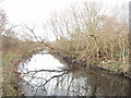
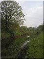
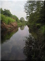
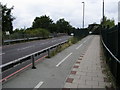


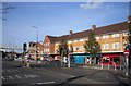

32 photos from this area
Area Information
Key information about the TW14 0AJ including its size, population, and administrative classification.
- Area Type
- Postcode
- Area Size
- 1.1 hectares
- Population
- 2311
- Population Density
- 8636 people/km²
House Prices in TW14 0AJ
35
Properties
£181,177
Average Sold Price
£48,000
Lowest Price
£435,000
Highest Price
Showing 35 properties
| Address | Type | Beds | Baths | Last Sale Price | Last Sale Date | |
|---|---|---|---|---|---|---|
| 52 The Drive, Feltham, TW14 0AJ | Detached | 3 | 1 | £435,000 | May 2025 | |
| 16 The Drive, Feltham, TW14 0AJ | Terraced | 2 | 1 | £270,000 | Oct 2014 | |
| 36 The Drive, Feltham, TW14 0AJ | Semi-detached | 3 | 1 | £300,000 | Aug 2014 | |
| 8 The Drive, Feltham, TW14 0AJ | house | - | - | £305,000 | Jan 2013 | |
| 22 The Drive, Feltham, TW14 0AJ | house | 2 | - | £198,000 | Jul 2011 | |
| 28 The Drive, Feltham, TW14 0AJ | house | - | - | £240,000 | Apr 2009 | |
| 62 The Drive, Feltham, TW14 0AJ | Semi-detached | - | - | £158,000 | Feb 2009 | |
| 48 The Drive, Feltham, TW14 0AJ | Terraced | 3 | 1 | £250,000 | Dec 2007 | |
| 60 The Drive, Feltham, TW14 0AJ | house | - | - | £204,000 | Jun 2004 | |
| 24 The Drive, Feltham, TW14 0AJ | Semi-detached | 2 | - | £155,950 | May 2003 |
Page 1 of 4
Energy Efficiency in TW14 0AJ
Amenities
Schools
| Rank | School | Type | Entry gender | Ages |
|---|
Explore more schools in this area
Go to Schools tabDemographics
Household Size
Family (3-5 people)
most common
Accommodation Type
Houses
most common
Tenure
65
majority
Ethnic Group
asian_total
most common
Religion
N/A
most common
Household Composition
N/A
most common
Age
47
median
Adults (30-64 years)
most common
Household Deprivation
N/A
with no deprivation
NS-SEC
22
in Lower managerial occupations
Explore more demographic insights in this area
Go to Demographics tabPlanning
Planning Constraints
- Flood RiskPremium
- Ramsar Wetland SitesPremium
- Area of Outstanding Natural BeautyPremium
- Protected Nature ReservePremium
- Protected WoodlandPremium