Area Overview for TW12 2AX
Photos of TW12 2AX
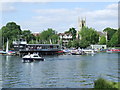

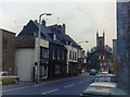
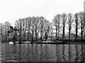
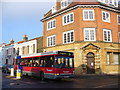
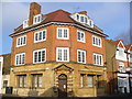
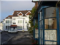
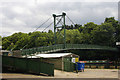

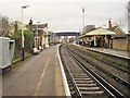
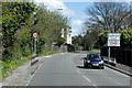

100 photos from this area
Area Information
Key information about the TW12 2AX including its size, population, and administrative classification.
- Area Type
- Postcode
- Area Size
- 1.4 hectares
- Population
- 1934
- Population Density
- 4247 people/km²
House Prices in TW12 2AX
34
Properties
£904,492
Average Sold Price
£140,000
Lowest Price
£5,402,884
Highest Price
Showing 34 properties
| Address | Type | Beds | Baths | Last Sale Price | Last Sale Date | |
|---|---|---|---|---|---|---|
| 76G Station Road, Hampton, TW12 2AX | Flat | 1 | 1 | £390,000 | Sep 2025 | |
| 76C Station Road, Hampton, TW12 2AX | Detached | 2 | 2 | £320,000 | Mar 2025 | |
| 76D Station Road, Hampton, TW12 2AX | Maisonette | 2 | 2 | £472,500 | Oct 2022 | |
| 80A Station Road, Hampton, TW12 2AX | Flat | - | - | £590,000 | Sep 2022 | |
| 74A Station Road, Hampton, TW12 2AX | Maisonette | 3 | 1 | £1,785,000 | Mar 2022 | |
| 76E Station Road, Hampton, TW12 2AX | house | - | - | £650,000 | Jun 2021 | |
| 76F Station Road, Hampton, TW12 2AX | Flat | - | - | £603,000 | Feb 2021 | |
| 76A Station Road, Hampton, TW12 2AX | Maisonette | 3 | 1 | £475,000 | Jan 2021 | |
| 74B Station Road, Hampton, TW12 2AX | Bungalow | - | - | £499,500 | Mar 2018 | |
| 74C Station Road, Hampton, TW12 2AX | house | - | - | £600,000 | Oct 2017 |
Page 1 of 4
Energy Efficiency in TW12 2AX
Amenities
Schools
| Rank | School | Type | Entry gender | Ages |
|---|
Explore more schools in this area
Go to Schools tabDemographics
Household Size
One person
most common
Accommodation Type
Houses
most common
Tenure
58
majority
Ethnic Group
White
most common
Religion
N/A
most common
Household Composition
N/A
most common
Age
47
median
Adults (30-64 years)
most common
Household Deprivation
N/A
with no deprivation
NS-SEC
50
in Lower managerial occupations
Explore more demographic insights in this area
Go to Demographics tabPlanning
Planning Constraints
- Flood RiskPremium
- Ramsar Wetland SitesPremium
- Area of Outstanding Natural BeautyPremium
- Protected Nature ReservePremium
- Protected WoodlandPremium