Area Overview for TW1 1PN
Photos of TW1 1PN
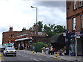
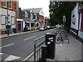
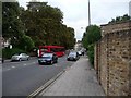
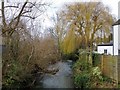


82 photos from this area
Area Information
Key information about the TW1 1PN including its size, population, and administrative classification.
- Area Type
- Postcode
- Area Size
- 7882 m²
- Population
- 1756
- Population Density
- 9132 people/km²
House Prices in TW1 1PN
28
Properties
£786,705
Average Sold Price
£96,500
Lowest Price
£1,730,000
Highest Price
Showing 28 properties
| Address | Type | Beds | Baths | Last Sale Price | Last Sale Date | |
|---|---|---|---|---|---|---|
| 285 St Margarets Road, Twickenham, TW1 1PN | Flat | - | - | £465,000 | Dec 2022 | |
| 319 St Margarets Road, Twickenham, TW1 1PN | house | 4 | 2 | £1,730,000 | Sep 2022 | |
| 305 St Margarets Road, Twickenham, TW1 1PN | house | 4 | 2 | £1,075,000 | Apr 2022 | |
| 309 St Margarets Road, Twickenham, TW1 1PN | Retail | 4 | 3 | £1,150,000 | Feb 2022 | |
| 307 St Margarets Road, Twickenham, TW1 1PN | Terraced | 3 | 1 | £935,000 | Mar 2021 | |
| 313 St Margarets Road, Twickenham, TW1 1PN | Terraced | 4 | 3 | £1,150,000 | Jan 2021 | |
| 289 St Margarets Road, Twickenham, TW1 1PN | Semi-detached | 4 | - | £1,475,000 | Sep 2020 | |
| 283 St Margarets Road, Twickenham, TW1 1PN | Flat | 2 | 1 | £440,000 | Jan 2018 | |
| 297 St Margarets Road, Twickenham, TW1 1PN | house | 3 | - | £1,600,000 | Aug 2016 | |
| 275 St Margarets Road, Twickenham, TW1 1PN | Semi-detached | 6 | - | £1,590,000 | Jun 2016 |
Page 1 of 3
Energy Efficiency in TW1 1PN
Amenities
Schools
| Rank | School | Type | Entry gender | Ages |
|---|
Explore more schools in this area
Go to Schools tabDemographics
Household Size
Family (3-5 people)
most common
Accommodation Type
Houses
most common
Tenure
66
majority
Ethnic Group
White
most common
Religion
N/A
most common
Household Composition
N/A
most common
Age
47
median
Adults (30-64 years)
most common
Household Deprivation
N/A
with no deprivation
NS-SEC
60
in Lower managerial occupations
Explore more demographic insights in this area
Go to Demographics tabPlanning
Planning Constraints
- Flood RiskPremium
- Ramsar Wetland SitesPremium
- Area of Outstanding Natural BeautyPremium
- Protected Nature ReservePremium
- Protected WoodlandPremium