Area Overview for TW1 1PH
Photos of TW1 1PH
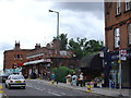
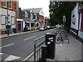
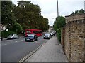
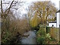
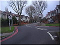

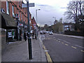
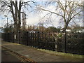
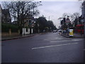

82 photos from this area
Area Information
Key information about the TW1 1PH including its size, population, and administrative classification.
- Area Type
- Postcode
- Area Size
- 7611 m²
- Population
- 1756
- Population Density
- 9132 people/km²
House Prices in TW1 1PH
38
Properties
£712,796
Average Sold Price
£3,500
Lowest Price
£1,105,000
Highest Price
Showing 38 properties
| Address | Type | Beds | Baths | Last Sale Price | Last Sale Date | |
|---|---|---|---|---|---|---|
| 90 Haliburton Road, Twickenham, TW1 1PH | Terraced | 3 | 2 | £1,105,000 | Jul 2025 | |
| 74 Haliburton Road, Twickenham, TW1 1PH | Terraced | 2 | 1 | £717,500 | Aug 2024 | |
| 92 Haliburton Road, Twickenham, TW1 1PH | Terraced | 3 | 1 | £845,000 | Feb 2024 | |
| 106 Haliburton Road, Twickenham, TW1 1PH | Detached | 4 | 2 | £1,040,000 | Nov 2023 | |
| 82 Haliburton Road, Twickenham, TW1 1PH | Terraced | 3 | 2 | £1,025,000 | Nov 2022 | |
| 142 Haliburton Road, Twickenham, TW1 1PH | house | - | - | £989,950 | Dec 2021 | |
| 98 Haliburton Road, Twickenham, TW1 1PH | Terraced | 3 | 1 | £1,019,995 | Apr 2021 | |
| 120 Haliburton Road, Twickenham, TW1 1PH | Detached | 3 | 2 | £906,950 | Dec 2020 | |
| 122 Haliburton Road, Twickenham, TW1 1PH | house | 2 | 1 | £690,000 | Jul 2020 | |
| 72 Haliburton Road, Twickenham, TW1 1PH | Terraced | 2 | 3 | £605,000 | Aug 2019 |
Page 1 of 4
Energy Efficiency in TW1 1PH
Amenities
Schools
| Rank | School | Type | Entry gender | Ages |
|---|
Explore more schools in this area
Go to Schools tabDemographics
Household Size
Family (3-5 people)
most common
Accommodation Type
Houses
most common
Tenure
66
majority
Ethnic Group
White
most common
Religion
N/A
most common
Household Composition
N/A
most common
Age
47
median
Adults (30-64 years)
most common
Household Deprivation
N/A
with no deprivation
NS-SEC
60
in Lower managerial occupations
Explore more demographic insights in this area
Go to Demographics tabPlanning
Planning Constraints
- Flood RiskPremium
- Ramsar Wetland SitesPremium
- Area of Outstanding Natural BeautyPremium
- Protected Nature ReservePremium
- Protected WoodlandPremium