Area Overview for TW1 1LE
Photos of TW1 1LE
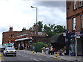
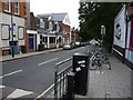
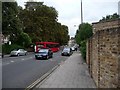
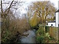
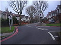

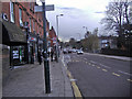
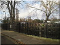


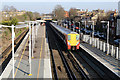
82 photos from this area
Area Information
Key information about the TW1 1LE including its size, population, and administrative classification.
- Area Type
- Postcode
- Area Size
- 7540 m²
- Population
- 1694
- Population Density
- 11007 people/km²
House Prices in TW1 1LE
37
Properties
£872,827
Average Sold Price
£249,950
Lowest Price
£1,525,000
Highest Price
Showing 37 properties
| Address | Type | Beds | Baths | Last Sale Price | Last Sale Date | |
|---|---|---|---|---|---|---|
| 77 Winchester Road, Twickenham, TW1 1LE | Terraced | 5 | 2 | £1,500,000 | Apr 2024 | |
| 49 Winchester Road, Twickenham, TW1 1LE | Semi-detached | 5 | 2 | £1,525,000 | Nov 2023 | |
| 39 Winchester Road, Twickenham, TW1 1LE | Terraced | 3 | 1 | £975,000 | Aug 2023 | |
| 31A Winchester Road, Twickenham, TW1 1LE | Maisonette | 2 | 1 | £525,000 | Nov 2022 | |
| 21 Winchester Road, Twickenham, TW1 1LE | Terraced | 3 | 2 | £799,000 | Nov 2022 | |
| 73 Winchester Road, Twickenham, TW1 1LE | Semi-detached | 3 | 1 | £1,350,000 | Oct 2022 | |
| 41 Winchester Road, Twickenham, TW1 1LE | Terraced | 3 | - | £1,170,000 | Nov 2020 | |
| 57 Winchester Road, Twickenham, TW1 1LE | Semi-detached | 4 | 2 | £1,265,000 | Apr 2018 | |
| 55 Winchester Road, Twickenham, TW1 1LE | Semi-detached | 4 | - | £1,290,000 | Dec 2016 | |
| 75 Winchester Road, Twickenham, TW1 1LE | Detached | 4 | 2 | £1,075,250 | Jul 2015 |
Page 1 of 4
Energy Efficiency in TW1 1LE
Amenities
Schools
| Rank | School | Type | Entry gender | Ages |
|---|
Explore more schools in this area
Go to Schools tabDemographics
Household Size
Family (3-5 people)
most common
Accommodation Type
Houses
most common
Tenure
77
majority
Ethnic Group
White
most common
Religion
N/A
most common
Household Composition
N/A
most common
Age
47
median
Adults (30-64 years)
most common
Household Deprivation
N/A
with no deprivation
NS-SEC
68
in Lower managerial occupations
Explore more demographic insights in this area
Go to Demographics tabPlanning
Planning Constraints
- Flood RiskPremium
- Ramsar Wetland SitesPremium
- Area of Outstanding Natural BeautyPremium
- Protected Nature ReservePremium
- Protected WoodlandPremium