Area Overview for TW1 1BT
Photos of TW1 1BT

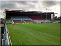
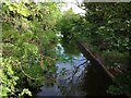
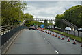
68 photos from this area
Area Information
Key information about the TW1 1BT including its size, population, and administrative classification.
- Area Type
- Postcode
- Area Size
- 3676 m²
- Population
- 2100
- Population Density
- 4908 people/km²
House Prices in TW1 1BT
15
Properties
£558,000
Average Sold Price
£70,000
Lowest Price
£1,270,000
Highest Price
Showing 15 properties
| Address | Type | Beds | Baths | Last Sale Price | Last Sale Date | |
|---|---|---|---|---|---|---|
| 59 Whitton Road, Twickenham, TW1 1BT | Maisonette | 2 | 1 | £442,000 | Nov 2024 | |
| 83 Whitton Road, Twickenham, TW1 1BT | Semi-detached | 3 | 2 | £1,250,000 | Sep 2020 | |
| 57 Whitton Road, Twickenham, TW1 1BT | Maisonette | 2 | 1 | £420,000 | Oct 2016 | |
| Heathfield House, 85 Whitton Road, Twickenham, TW1 1BT | Semi-detached | 5 | - | £1,270,000 | Apr 2013 | |
| 55 Whitton Road, Twickenham, TW1 1BT | Maisonette | 2 | 1 | £250,000 | Sep 2011 | |
| 51 Whitton Road, Twickenham, TW1 1BT | Flat | 3 | 2 | £235,000 | Feb 2011 | |
| 77 Whitton Road, Twickenham, TW1 1BT | house | - | - | £620,000 | Jan 2010 | |
| 75 Whitton Road, Twickenham, TW1 1BT | house | - | - | £685,000 | Oct 2009 | |
| 71 Whitton Road, Twickenham, TW1 1BT | Semi-detached | - | - | £338,000 | Aug 2004 | |
| 61 Whitton Road, Twickenham, TW1 1BT | Flat | - | - | £70,000 | Feb 1996 |
Page 1 of 2
Energy Efficiency in TW1 1BT
Amenities
Schools
| Rank | School | Type | Entry gender | Ages |
|---|
Explore more schools in this area
Go to Schools tabDemographics
Household Size
Family (3-5 people)
most common
Accommodation Type
Houses
most common
Tenure
71
majority
Ethnic Group
White
most common
Religion
N/A
most common
Household Composition
N/A
most common
Age
47
median
Adults (30-64 years)
most common
Household Deprivation
N/A
with no deprivation
NS-SEC
62
in Lower managerial occupations
Explore more demographic insights in this area
Go to Demographics tabPlanning
Planning Constraints
- Flood RiskPremium
- Ramsar Wetland SitesPremium
- Area of Outstanding Natural BeautyPremium
- Protected Nature ReservePremium
- Protected WoodlandPremium