Area Overview for TN16 3AG
Photos of TN16 3AG
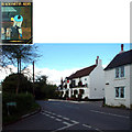
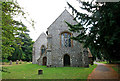
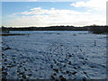
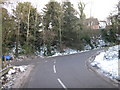
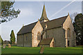
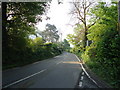
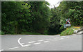
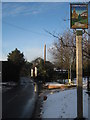
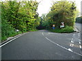
85 photos from this area
Area Information
Key information about the TN16 3AG including its size, population, and administrative classification.
- Area Type
- Postcode
- Area Size
- 33.1 hectares
- Population
- 2029
- Population Density
- 204 people/km²
House Prices in TN16 3AG
21
Properties
£560,875
Average Sold Price
£400,000
Lowest Price
£780,000
Highest Price
Showing 21 properties
| Address | Type | Beds | Baths | Last Sale Price | Last Sale Date | |
|---|---|---|---|---|---|---|
| Jaro, Berrys Hill, Berrys Green, Westerham, TN16 3AG | Bungalow | 4 | 3 | £550,000 | Nov 2022 | |
| Hill Crest, Berrys Hill, Berrys Green, Westerham, TN16 3AG | Detached | 4 | 2 | £662,000 | Jul 2018 | |
| St Helliers, Berrys Hill, Berrys Green, Westerham, TN16 3AG | Detached | 5 | 2 | £600,000 | Apr 2017 | |
| St Leonards, Berrys Hill, Berrys Green, Westerham, TN16 3AG | Detached | 3 | 1 | £550,000 | Oct 2016 | |
| Glen Haven, Berrys Hill, Berrys Green, Westerham, TN16 3AG | Detached | 3 | - | £780,000 | Jul 2015 | |
| The Croft, Berrys Hill, Berrys Green, Westerham, TN16 3AG | house | 5 | - | £515,000 | Apr 2013 | |
| St Aubyns, Berrys Hill, Berrys Green, Westerham, TN16 3AG | Detached | 4 | 2 | £430,000 | Jul 2007 | |
| Christmas Cottage, Berrys Hill, Berrys Green, Westerham, TN16 3AG | Detached | - | - | £400,000 | Oct 2004 | |
| Lorenzo, Berrys Hill, Berrys Green, Westerham, TN16 3AG | Bungalow | 4 | 3 | - | - | |
| Bottom Barn Farm, Berrys Hill, Berrys Green, Westerham, TN16 3AG | Detached | 3 | - | - | - |
Page 1 of 3
Energy Efficiency in TN16 3AG
Amenities
Schools
| Rank | School | Type | Entry gender | Ages |
|---|
Explore more schools in this area
Go to Schools tabDemographics
Household Size
Family (3-5 people)
most common
Accommodation Type
Houses
most common
Tenure
79
majority
Ethnic Group
White
most common
Religion
N/A
most common
Household Composition
N/A
most common
Age
47
median
Adults (30-64 years)
most common
Household Deprivation
N/A
with no deprivation
NS-SEC
39
in Lower managerial occupations
Explore more demographic insights in this area
Go to Demographics tabPlanning
Planning Constraints
- Flood RiskPremium
- Ramsar Wetland SitesPremium
- Area of Outstanding Natural BeautyPremium
- Protected Nature ReservePremium
- Protected WoodlandPremium