Area Overview for TN14 7QF
Photos of TN14 7QF
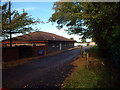
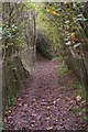
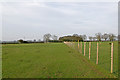


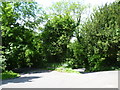

46 photos from this area
Area Information
Key information about the TN14 7QF including its size, population, and administrative classification.
- Area Type
- Postcode
- Area Size
- 30.0 hectares
- Population
- 1687
- Population Density
- 171 people/km²
House Prices in TN14 7QF
13
Properties
£927,984
Average Sold Price
£133,524
Lowest Price
£2,634,380
Highest Price
Showing 13 properties
| Address | Type | Beds | Baths | Last Sale Price | Last Sale Date | |
|---|---|---|---|---|---|---|
| Pinehurst, Church Approach, Cudham, Sevenoaks, TN14 7QF | Detached | 3 | 2 | £410,000 | Dec 2022 | |
| Rose Cottage, Church Approach, Cudham, Sevenoaks, TN14 7QF | house | - | - | £900,000 | Aug 2017 | |
| Gables, Church Approach, Cudham, Sevenoaks, TN14 7QF | Semi-detached | 3 | 2 | £760,000 | Mar 2017 | |
| Rectory House, Church Approach, Cudham, Sevenoaks, TN14 7QF | Detached | 4 | 4 | £2,634,380 | Mar 2014 | |
| Oastside, Church Approach, Cudham, Sevenoaks, TN14 7QF | Terraced | - | - | £133,524 | Jun 2013 | |
| Pine Close, Church Approach, Cudham, Sevenoaks, TN14 7QF | Detached | - | - | £730,000 | May 2006 | |
| Coach House, Church Approach, Cudham, Sevenoaks, TN14 7QF | house | 4 | - | - | - | |
| The Oast House, Church Approach, Cudham, Sevenoaks, TN14 7QF | Terraced | - | - | - | - | |
| Angus Cottage, Church Approach, Cudham, Sevenoaks, TN14 7QF | Detached | - | - | - | - | |
| Cudham Court Farm, Church Approach, Cudham, Sevenoaks, TN14 7QF | Terraced | - | - | - | - |
Page 1 of 2
Energy Efficiency in TN14 7QF
Amenities
Schools
| Rank | School | Type | Entry gender | Ages |
|---|
Explore more schools in this area
Go to Schools tabDemographics
Household Size
Two person
most common
Accommodation Type
Houses
most common
Tenure
91
majority
Ethnic Group
White
most common
Religion
N/A
most common
Household Composition
N/A
most common
Age
47
median
Adults (30-64 years)
most common
Household Deprivation
N/A
with no deprivation
NS-SEC
38
in Lower managerial occupations
Explore more demographic insights in this area
Go to Demographics tabPlanning
Planning Constraints
- Flood RiskPremium
- Ramsar Wetland SitesPremium
- Area of Outstanding Natural BeautyPremium
- Protected Nature ReservePremium
- Protected WoodlandPremium