Area Overview for TN14 7HW
Photos of TN14 7HW


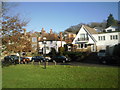


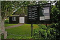


59 photos from this area
Area Information
Key information about the TN14 7HW including its size, population, and administrative classification.
- Area Type
- Postcode
- Area Size
- 3.9 hectares
- Population
- 1642
- Population Density
- 199 people/km²
House Prices in TN14 7HW
25
Properties
£663,600
Average Sold Price
£215,000
Lowest Price
£1,300,000
Highest Price
Showing 25 properties
| Address | Type | Beds | Baths | Last Sale Price | Last Sale Date | |
|---|---|---|---|---|---|---|
| The Hermitage, Stonehouse Road, Halstead, TN14 7HW | Detached | 4 | 2 | £800,000 | Oct 2025 | |
| Ivydene, Stonehouse Road, Halstead, TN14 7HW | Bungalow | 3 | 2 | £860,000 | Apr 2024 | |
| Marston, Stonehouse Road, Orpington, TN14 7HW | Detached | 4 | 2 | £1,025,000 | Jul 2022 | |
| Penrhyn, Stonehouse Road, Halstead, TN14 7HW | house | - | - | £1,300,000 | Jun 2022 | |
| Kildallon, Stonehouse Road, Halstead, TN14 7HW | Bungalow | 2 | 1 | £465,000 | Mar 2021 | |
| Wildernesse, Stonehouse Road, Halstead, TN14 7HW | Detached | 4 | 2 | £740,000 | Feb 2020 | |
| Coltswood, Stonehouse Road, Orpington, TN14 7HW | Bungalow | 5 | 2 | £565,000 | Oct 2018 | |
| Cobblecroft, Stonehouse Road, Orpington, TN14 7HW | Bungalow | 3 | - | £735,000 | May 2018 | |
| Whitecroft, Stonehouse Road, Orpington, TN14 7HW | Detached | 4 | 4 | £685,000 | Jan 2016 | |
| Old Oak Cottage, Stonehouse Road, Orpington, TN14 7HW | Detached | 4 | 3 | £780,000 | May 2013 |
Page 1 of 3
Energy Efficiency in TN14 7HW
Amenities
Schools
| Rank | School | Type | Entry gender | Ages |
|---|
Explore more schools in this area
Go to Schools tabDemographics
Household Size
Two person
most common
Accommodation Type
Houses
most common
Tenure
88
majority
Ethnic Group
White
most common
Religion
N/A
most common
Household Composition
N/A
most common
Age
47
median
Adults (30-64 years)
most common
Household Deprivation
N/A
with no deprivation
NS-SEC
47
in Lower managerial occupations
Explore more demographic insights in this area
Go to Demographics tabPlanning
Planning Constraints
- Flood RiskPremium
- Ramsar Wetland SitesPremium
- Area of Outstanding Natural BeautyPremium
- Protected Nature ReservePremium
- Protected WoodlandPremium