Area Overview for SW6 3SL
Photos of SW6 3SL
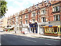
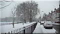
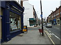
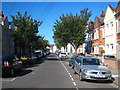
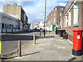
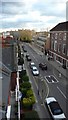
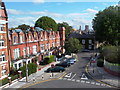
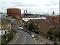
100 photos from this area
Area Information
Key information about the SW6 3SL including its size, population, and administrative classification.
- Area Type
- Postcode
- Area Size
- 8534 m²
- Population
- 1572
- Population Density
- 11078 people/km²
House Prices in SW6 3SL
34
Properties
£1,751,897
Average Sold Price
£363,000
Lowest Price
£3,850,000
Highest Price
Showing 34 properties
| Address | Type | Beds | Baths | Last Sale Price | Last Sale Date | |
|---|---|---|---|---|---|---|
| 7 Studdridge Street, London, SW6 3SL | Terraced | 3 | - | £3,850,000 | Apr 2025 | |
| 19 Studdridge Street, London, SW6 3SL | Terraced | 4 | 2 | £2,100,000 | Jul 2023 | |
| 29 Studdridge Street, London, SW6 3SL | Terraced | 3 | 1 | £2,325,000 | May 2023 | |
| 43 Studdridge Street, London, SW6 3SL | Terraced | 4 | 2 | £1,990,000 | Feb 2022 | |
| 9 Studdridge Street, London, SW6 3SL | Terraced | 5 | 4 | £2,762,000 | Mar 2021 | |
| 13 Studdridge Street, London, SW6 3SL | house | - | - | £2,600,000 | Jan 2021 | |
| 47 Studdridge Street, London, SW6 3SL | Terraced | 3 | 2 | £1,730,000 | Oct 2020 | |
| 15 Studdridge Street, London, SW6 3SL | Terraced | 4 | 4 | £3,250,000 | May 2019 | |
| 27 Studdridge Street, London, SW6 3SL | house | - | - | £2,350,000 | Mar 2018 | |
| 45 Studdridge Street, London, SW6 3SL | Terraced | 4 | 3 | £2,435,000 | Aug 2014 |
Page 1 of 4
Energy Efficiency in SW6 3SL
Amenities
Schools
| Rank | School | Type | Entry gender | Ages |
|---|
Explore more schools in this area
Go to Schools tabDemographics
Household Size
Family (3-5 people)
most common
Accommodation Type
Houses
most common
Tenure
56
majority
Ethnic Group
White
most common
Religion
N/A
most common
Household Composition
N/A
most common
Age
47
median
Adults (30-64 years)
most common
Household Deprivation
N/A
with no deprivation
NS-SEC
56
in Lower managerial occupations
Explore more demographic insights in this area
Go to Demographics tabPlanning
Planning Constraints
- Flood RiskPremium
- Ramsar Wetland SitesPremium
- Area of Outstanding Natural BeautyPremium
- Protected Nature ReservePremium
- Protected WoodlandPremium