Area Overview for SW6 2TF
Photos of SW6 2TF
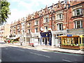

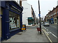
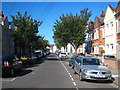
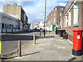
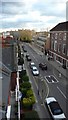
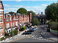
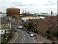

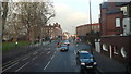
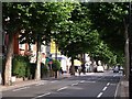
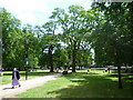
100 photos from this area
Area Information
Key information about the SW6 2TF including its size, population, and administrative classification.
- Area Type
- Postcode
- Area Size
- 5494 m²
- Population
- 1572
- Population Density
- 11078 people/km²
House Prices in SW6 2TF
95
Properties
£521,875
Average Sold Price
£220,000
Lowest Price
£865,000
Highest Price
Showing 95 properties
| Address | Type | Beds | Baths | Last Sale Price | Last Sale Date | |
|---|---|---|---|---|---|---|
| UPPER FLAT, 98 WANDSWORTH BRIDGE ROAD, London, SW6 2TF | Flat | - | - | £250,000 | Jan 2024 | |
| Room 3, 106 Wandsworth Bridge Road, London, SW6 2TF | Terraced | - | - | £350,000 | Oct 2023 | |
| Room 4, 106 Wandsworth Bridge Road, London, SW6 2TF | Terraced | - | - | £865,000 | May 2022 | |
| Room 2, 106 Wandsworth Bridge Road, London, SW6 2TF | Terraced | - | - | £710,000 | Dec 2021 | |
| Room 1, 106 Wandsworth Bridge Road, London, SW6 2TF | Terraced | - | - | £700,000 | Nov 2021 | |
| Room 5, 106 Wandsworth Bridge Road, London, SW6 2TF | Terraced | - | - | £830,000 | Jun 2021 | |
| Maisonette First And Second Floors, 100 Wandsworth Bridge Road, London, SW6 2TF | Retail | 3 | 2 | £250,000 | Aug 2015 | |
| 94A Wandsworth Bridge Road, London, SW6 2TF | Maisonette | 1 | 1 | £220,000 | Apr 1998 | |
| Flat 4, 78 Wandsworth Bridge Road, London, SW6 2TF | Flat | 2 | 2 | - | - | |
| Flat 3, 100A Wandsworth Bridge Road, London, SW6 2TF | Flat | 1 | 1 | - | - |
Page 1 of 10
Energy Efficiency in SW6 2TF
Amenities
Schools
| Rank | School | Type | Entry gender | Ages |
|---|
Explore more schools in this area
Go to Schools tabDemographics
Household Size
Family (3-5 people)
most common
Accommodation Type
Houses
most common
Tenure
56
majority
Ethnic Group
White
most common
Religion
N/A
most common
Household Composition
N/A
most common
Age
47
median
Adults (30-64 years)
most common
Household Deprivation
N/A
with no deprivation
NS-SEC
56
in Lower managerial occupations
Explore more demographic insights in this area
Go to Demographics tabPlanning
Planning Constraints
- Flood RiskPremium
- Ramsar Wetland SitesPremium
- Area of Outstanding Natural BeautyPremium
- Protected Nature ReservePremium
- Protected WoodlandPremium