Area Overview for SW3 2ED
Photos of SW3 2ED
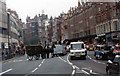
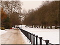

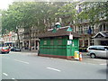
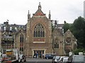
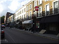
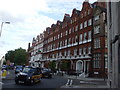
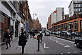
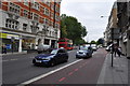
100 photos from this area
Area Information
Key information about the SW3 2ED including its size, population, and administrative classification.
- Area Type
- Postcode
- Area Size
- 6944 m²
- Population
- 1088
- Population Density
- 5075 people/km²
House Prices in SW3 2ED
18
Properties
£8,935,067
Average Sold Price
£442,500
Lowest Price
£15,800,000
Highest Price
Showing 18 properties
| Address | Type | Beds | Baths | Last Sale Price | Last Sale Date | |
|---|---|---|---|---|---|---|
| 53 Egerton Crescent, London, SW3 2ED | Terraced | 5 | 3 | £9,300,000 | Sep 2023 | |
| 47 Egerton Crescent, London, SW3 2ED | Terraced | - | - | £15,800,000 | Sep 2022 | |
| 46 Egerton Crescent, London, SW3 2ED | Terraced | 6 | 5 | £13,343,850 | Aug 2022 | |
| 44 Egerton Crescent, London, SW3 2ED | Terraced | 6 | 3 | £13,750,000 | Jul 2020 | |
| 51 Egerton Crescent, London, SW3 2ED | Terraced | 4 | 4 | £14,050,000 | Jul 2020 | |
| 54 Egerton Crescent, London, SW3 2ED | Terraced | - | - | £11,550,000 | Nov 2017 | |
| 56 Egerton Crescent, London, SW3 2ED | Terraced | 4 | 4 | £15,250,000 | Dec 2016 | |
| 57 Egerton Crescent, London, SW3 2ED | Semi-detached | 5 | 5 | £12,161,660 | Nov 2016 | |
| 52 Egerton Crescent, London, SW3 2ED | Semi-detached | 5 | - | £10,500,000 | Aug 2013 | |
| 48 Egerton Crescent, London, SW3 2ED | house | - | - | £10,000,000 | Oct 2008 |
Page 1 of 2
Energy Efficiency in SW3 2ED
Amenities
Schools
| Rank | School | Type | Entry gender | Ages |
|---|
Explore more schools in this area
Go to Schools tabDemographics
Household Size
One person
most common
Accommodation Type
Flats
most common
Tenure
35
majority
Ethnic Group
White
most common
Religion
N/A
most common
Household Composition
N/A
most common
Age
47
median
Adults (30-64 years)
most common
Household Deprivation
N/A
with no deprivation
NS-SEC
57
in Lower managerial occupations
Explore more demographic insights in this area
Go to Demographics tabPlanning
Planning Constraints
- Flood RiskPremium
- Ramsar Wetland SitesPremium
- Area of Outstanding Natural BeautyPremium
- Protected Nature ReservePremium
- Protected WoodlandPremium