Area Overview for SW3 2EB
Photos of SW3 2EB
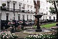
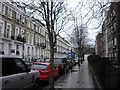
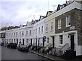
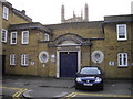
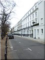
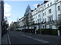
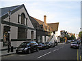
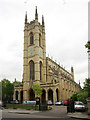


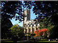
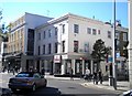
100 photos from this area
Area Information
Key information about the SW3 2EB including its size, population, and administrative classification.
- Area Type
- Postcode
- Area Size
- 5827 m²
- Population
- 1080
- Population Density
- 5646 people/km²
House Prices in SW3 2EB
23
Properties
£6,494,257
Average Sold Price
£345,000
Lowest Price
£14,650,000
Highest Price
Showing 23 properties
| Address | Type | Beds | Baths | Last Sale Price | Last Sale Date | |
|---|---|---|---|---|---|---|
| 28 Egerton Crescent, London, SW3 2EB | Terraced | 3 | 3 | £9,415,000 | Jan 2024 | |
| 31 Egerton Crescent, London, SW3 2EB | Terraced | 6 | 4 | £11,565,000 | Apr 2022 | |
| 39 Egerton Crescent, London, SW3 2EB | Semi-detached | 5 | 4 | £14,250,000 | Jan 2022 | |
| Former, 42 Egerton Crescent, London, SW3 2EB | Detached | 4 | - | £14,650,000 | Nov 2014 | |
| 37 Egerton Crescent, London, SW3 2EB | house | 5 | - | £12,000,000 | Apr 2012 | |
| 38 Egerton Crescent, London, SW3 2EB | house | 5 | - | £5,300,000 | Jan 2011 | |
| 41 Egerton Crescent, London, SW3 2EB | house | - | - | £11,500,000 | Dec 2009 | |
| 40 Egerton Crescent, London, SW3 2EB | house | - | - | £9,250,000 | Jun 2008 | |
| 32 Egerton Crescent, London, SW3 2EB | house | - | - | £4,300,000 | Feb 2005 | |
| 29 Egerton Crescent, London, SW3 2EB | house | 6 | - | £384,850 | Jul 1999 |
Page 1 of 3
Energy Efficiency in SW3 2EB
Amenities
Schools
| Rank | School | Type | Entry gender | Ages |
|---|
Explore more schools in this area
Go to Schools tabDemographics
Household Size
One person
most common
Accommodation Type
Flats
most common
Tenure
48
majority
Ethnic Group
White
most common
Religion
N/A
most common
Household Composition
N/A
most common
Age
47
median
Adults (30-64 years)
most common
Household Deprivation
N/A
with no deprivation
NS-SEC
55
in Lower managerial occupations
Explore more demographic insights in this area
Go to Demographics tabPlanning
Planning Constraints
- Flood RiskPremium
- Ramsar Wetland SitesPremium
- Area of Outstanding Natural BeautyPremium
- Protected Nature ReservePremium
- Protected WoodlandPremium