Area Overview for SW19 8HD
Photos of SW19 8HD

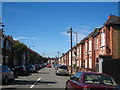
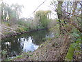
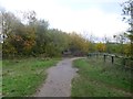
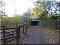
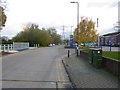
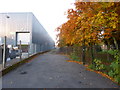
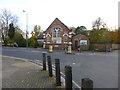

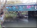
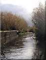
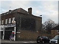
97 photos from this area
Area Information
Key information about the SW19 8HD including its size, population, and administrative classification.
- Area Type
- Postcode
- Area Size
- 1.6 hectares
- Population
- 1875
- Population Density
- 5580 people/km²
House Prices in SW19 8HD
55
Properties
£551,713
Average Sold Price
£154,000
Lowest Price
£950,000
Highest Price
Showing 55 properties
| Address | Type | Beds | Baths | Last Sale Price | Last Sale Date | |
|---|---|---|---|---|---|---|
| 56 Havelock Road, Wimbledon, London, SW19 8HD | Terraced | 4 | 2 | £940,000 | Dec 2025 | |
| 44 Havelock Road, Wimbledon, London, SW19 8HD | Terraced | 4 | 2 | £929,000 | Sep 2025 | |
| 4 Havelock Road, Wimbledon, London, SW19 8HD | Maisonette | 2 | 1 | £500,000 | Mar 2025 | |
| 48 Havelock Road, Wimbledon, London, SW19 8HD | Flat | 2 | 1 | £847,000 | Nov 2024 | |
| 46 Havelock Road, Wimbledon, London, SW19 8HD | house | 4 | 2 | £950,000 | Sep 2024 | |
| 40 Havelock Road, Wimbledon, London, SW19 8HD | Terraced | 4 | 2 | £880,000 | Jul 2024 | |
| 4A Havelock Road, Wimbledon, London, SW19 8HD | Maisonette | 2 | 1 | £525,000 | Jul 2024 | |
| 50 Havelock Road, Wimbledon, London, SW19 8HD | Detached | 4 | 2 | £856,800 | Mar 2024 | |
| 66 Havelock Road, Wimbledon, London, SW19 8HD | Maisonette | 2 | 1 | £520,000 | Jan 2024 | |
| 72A Havelock Road, Wimbledon, London, SW19 8HD | Semi-detached | 3 | 1 | £599,950 | Nov 2023 |
Page 1 of 6
Energy Efficiency in SW19 8HD
Amenities
Schools
| Rank | School | Type | Entry gender | Ages |
|---|
Explore more schools in this area
Go to Schools tabDemographics
Household Size
Two person
most common
Accommodation Type
Flats
most common
Tenure
39
majority
Ethnic Group
White
most common
Religion
N/A
most common
Household Composition
N/A
most common
Age
47
median
Adults (30-64 years)
most common
Household Deprivation
N/A
with no deprivation
NS-SEC
55
in Lower managerial occupations
Explore more demographic insights in this area
Go to Demographics tabPlanning
Planning Constraints
- Flood RiskPremium
- Ramsar Wetland SitesPremium
- Area of Outstanding Natural BeautyPremium
- Protected Nature ReservePremium
- Protected WoodlandPremium