Area Overview for SW19 2NB
Photos of SW19 2NB
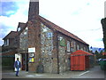
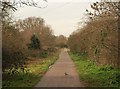
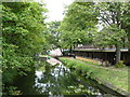
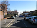
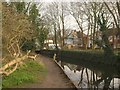
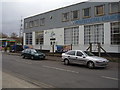

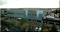
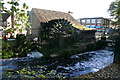
100 photos from this area
Area Information
Key information about the SW19 2NB including its size, population, and administrative classification.
- Area Type
- Postcode
- Area Size
- 7134 m²
- Population
- 1867
- Population Density
- 5632 people/km²
House Prices in SW19 2NB
48
Properties
£367,816
Average Sold Price
£59,000
Lowest Price
£800,000
Highest Price
Showing 48 properties
| Address | Type | Beds | Baths | Last Sale Price | Last Sale Date | |
|---|---|---|---|---|---|---|
| 23 Dane Road, Colliers Wood, SW19 2NB | Terraced | 2 | 1 | £667,500 | Dec 2022 | |
| 9 Dane Road, Colliers Wood, SW19 2NB | house | - | - | £570,000 | Oct 2021 | |
| 38 Dane Road, Colliers Wood, SW19 2NB | house | - | - | £710,000 | Mar 2021 | |
| 15 Dane Road, Colliers Wood, SW19 2NB | Terraced | 3 | 2 | £800,000 | Nov 2020 | |
| 35 Dane Road, Colliers Wood, SW19 2NB | Terraced | 3 | 1 | £525,000 | Oct 2020 | |
| 32 Dane Road, Colliers Wood, SW19 2NB | house | - | - | £550,000 | May 2018 | |
| 31 Dane Road, Colliers Wood, SW19 2NB | Terraced | 2 | 1 | £577,000 | Nov 2017 | |
| 1 Dane Road, Colliers Wood, SW19 2NB | Terraced | 2 | 1 | £520,000 | Oct 2015 | |
| 42 Dane Road, Colliers Wood, SW19 2NB | house | - | - | £515,000 | Oct 2015 | |
| 44 Dane Road, Colliers Wood, SW19 2NB | Terraced | 2 | - | £460,000 | Jun 2014 |
Page 1 of 5
Energy Efficiency in SW19 2NB
Amenities
Schools
| Rank | School | Type | Entry gender | Ages |
|---|
Explore more schools in this area
Go to Schools tabDemographics
Household Size
Family (3-5 people)
most common
Accommodation Type
Flats
most common
Tenure
24
majority
Ethnic Group
White
most common
Religion
N/A
most common
Household Composition
N/A
most common
Age
47
median
Adults (30-64 years)
most common
Household Deprivation
N/A
with no deprivation
NS-SEC
28
in Lower managerial occupations
Explore more demographic insights in this area
Go to Demographics tabPlanning
Planning Constraints
- Flood RiskPremium
- Ramsar Wetland SitesPremium
- Area of Outstanding Natural BeautyPremium
- Protected Nature ReservePremium
- Protected WoodlandPremium