Area Overview for SW19 1DW
Photos of SW19 1DW
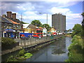

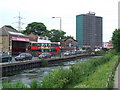

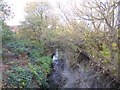
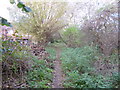


100 photos from this area
Area Information
Key information about the SW19 1DW including its size, population, and administrative classification.
- Area Type
- Postcode
- Area Size
- 2.0 hectares
- Population
- 1748
- Population Density
- 10307 people/km²
House Prices in SW19 1DW
43
Properties
£531,531
Average Sold Price
£75,000
Lowest Price
£1,800,000
Highest Price
Showing 43 properties
| Address | Type | Beds | Baths | Last Sale Price | Last Sale Date | |
|---|---|---|---|---|---|---|
| 1B Wandle Bank, Colliers Wood, London, SW19 1DW | Detached | 3 | 1 | £595,000 | Aug 2025 | |
| 40 Wandle Bank, Colliers Wood, London, SW19 1DW | Terraced | 3 | 2 | £925,000 | Jan 2025 | |
| 43 Wandle Bank, Colliers Wood, London, SW19 1DW | Terraced | 3 | 1 | £625,000 | May 2024 | |
| 34 Wandle Bank, Colliers Wood, London, SW19 1DW | Terraced | 2 | 2 | £570,000 | Nov 2023 | |
| 38 Wandle Bank, Colliers Wood, London, SW19 1DW | Terraced | 3 | 2 | £725,000 | Apr 2021 | |
| 48 Wandle Bank, Colliers Wood, London, SW19 1DW | Terraced | 2 | 1 | £875,000 | Oct 2020 | |
| 35 Wandle Bank, Colliers Wood, London, SW19 1DW | Terraced | 2 | - | £632,876 | Sep 2020 | |
| 1A Wandle Bank, Colliers Wood, London, SW19 1DW | Semi-detached | 3 | 1 | £575,000 | Jun 2020 | |
| 39 Wandle Bank, Colliers Wood, London, SW19 1DW | house | - | - | £460,000 | Mar 2018 | |
| 44 Wandle Bank, Colliers Wood, London, SW19 1DW | Terraced | 2 | - | £615,000 | Aug 2017 |
Page 1 of 5
Energy Efficiency in SW19 1DW
Amenities
Schools
| Rank | School | Type | Entry gender | Ages |
|---|
Explore more schools in this area
Go to Schools tabDemographics
Household Size
One person
most common
Accommodation Type
Houses
most common
Tenure
47
majority
Ethnic Group
White
most common
Religion
N/A
most common
Household Composition
N/A
most common
Age
47
median
Adults (30-64 years)
most common
Household Deprivation
N/A
with no deprivation
NS-SEC
52
in Lower managerial occupations
Explore more demographic insights in this area
Go to Demographics tabPlanning
Planning Constraints
- Flood RiskPremium
- Ramsar Wetland SitesPremium
- Area of Outstanding Natural BeautyPremium
- Protected Nature ReservePremium
- Protected WoodlandPremium