Area Overview for SW18 5NJ
Photos of SW18 5NJ

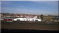
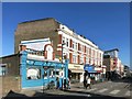
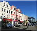
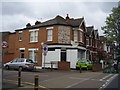
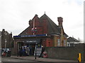
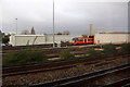
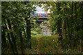
100 photos from this area
Area Information
Key information about the SW18 5NJ including its size, population, and administrative classification.
- Area Type
- Postcode
- Area Size
- 5045 m²
- Population
- 1911
- Population Density
- 5705 people/km²
House Prices in SW18 5NJ
33
Properties
£724,968
Average Sold Price
£100,000
Lowest Price
£1,172,000
Highest Price
Showing 33 properties
| Address | Type | Beds | Baths | Last Sale Price | Last Sale Date | |
|---|---|---|---|---|---|---|
| 15A Revelstoke Road, Wimbledon, SW18 5NJ | Maisonette | - | - | £420,000 | Mar 2025 | |
| 25 Revelstoke Road, Wimbledon, SW18 5NJ | Terraced | 4 | 2 | £1,170,000 | Sep 2023 | |
| 59A Revelstoke Road, Wimbledon, SW18 5NJ | Flat | - | - | £450,000 | Feb 2022 | |
| 1B Revelstoke Road, Wimbledon, SW18 5NJ | Flat | 2 | 2 | £520,000 | Aug 2021 | |
| 53 Revelstoke Road, Wimbledon, SW18 5NJ | Terraced | 3 | 1 | £1,075,000 | Nov 2020 | |
| 23 Revelstoke Road, Wimbledon, SW18 5NJ | Terraced | 4 | 2 | £1,172,000 | Jul 2020 | |
| 47 Revelstoke Road, Wimbledon, SW18 5NJ | Terraced | 4 | 3 | £1,065,000 | Dec 2019 | |
| 5 Revelstoke Road, Wimbledon, SW18 5NJ | Terraced | 3 | 1 | £810,000 | Aug 2018 | |
| 35 Revelstoke Road, Wimbledon, SW18 5NJ | Detached | 5 | 2 | £1,045,000 | Jul 2018 | |
| 3 Revelstoke Road, Wimbledon, SW18 5NJ | Terraced | 3 | 1 | £780,000 | Feb 2016 |
Page 1 of 4
Energy Efficiency in SW18 5NJ
Amenities
Schools
| Rank | School | Type | Entry gender | Ages |
|---|
Explore more schools in this area
Go to Schools tabDemographics
Household Size
Family (3-5 people)
most common
Accommodation Type
Houses
most common
Tenure
70
majority
Ethnic Group
White
most common
Religion
N/A
most common
Household Composition
N/A
most common
Age
47
median
Adults (30-64 years)
most common
Household Deprivation
N/A
with no deprivation
NS-SEC
60
in Lower managerial occupations
Explore more demographic insights in this area
Go to Demographics tabPlanning
Planning Constraints
- Flood RiskPremium
- Ramsar Wetland SitesPremium
- Area of Outstanding Natural BeautyPremium
- Protected Nature ReservePremium
- Protected WoodlandPremium