Area Overview for SW18 5AE
Photos of SW18 5AE

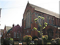
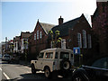
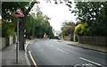
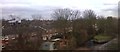
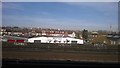
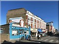
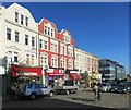
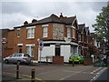

100 photos from this area
Area Information
Key information about the SW18 5AE including its size, population, and administrative classification.
- Area Type
- Postcode
- Area Size
- 1.4 hectares
- Population
- 2146
- Population Density
- 15039 people/km²
House Prices in SW18 5AE
67
Properties
£752,011
Average Sold Price
£125,000
Lowest Price
£1,365,000
Highest Price
Showing 67 properties
| Address | Type | Beds | Baths | Last Sale Price | Last Sale Date | |
|---|---|---|---|---|---|---|
| 448 Merton Road, London, SW18 5AE | Detached | 4 | 3 | £1,070,000 | Dec 2024 | |
| 450 Merton Road, London, SW18 5AE | house | - | - | £1,200,000 | Apr 2023 | |
| 456 Merton Road, London, SW18 5AE | house | - | - | £1,365,000 | Jul 2022 | |
| 458 Merton Road, London, SW18 5AE | Semi-detached | 5 | 2 | £1,286,500 | Jan 2020 | |
| 476 Merton Road, London, SW18 5AE | house | - | - | £1,000,000 | Oct 2019 | |
| 472 Merton Road, London, SW18 5AE | Flat | 3 | 2 | £690,000 | Nov 2015 | |
| 452 Merton Road, London, SW18 5AE | Semi-detached | 4 | 2 | £525,000 | Feb 2011 | |
| 478 Merton Road, London, SW18 5AE | house | - | - | £675,000 | Jan 2011 | |
| 466 Merton Road, London, SW18 5AE | house | - | - | £540,000 | Feb 2009 | |
| Vicarage Now Numbered As 146A Lavenham Road, 430 Merton Road, London, SW18 5AE | Detached | - | - | £1,346,212 | Nov 2008 |
Page 1 of 7
Energy Efficiency in SW18 5AE
Amenities
Schools
| Rank | School | Type | Entry gender | Ages |
|---|
Explore more schools in this area
Go to Schools tabDemographics
Household Size
Two person
most common
Accommodation Type
Flats
most common
Tenure
55
majority
Ethnic Group
White
most common
Religion
N/A
most common
Household Composition
N/A
most common
Age
47
median
Adults (30-64 years)
most common
Household Deprivation
N/A
with no deprivation
NS-SEC
71
in Lower managerial occupations
Explore more demographic insights in this area
Go to Demographics tabPlanning
Planning Constraints
- Flood RiskPremium
- Ramsar Wetland SitesPremium
- Area of Outstanding Natural BeautyPremium
- Protected Nature ReservePremium
- Protected WoodlandPremium