Area Overview for SW17 9BQ
Photos of SW17 9BQ
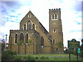
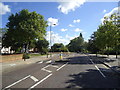
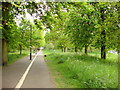
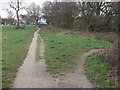
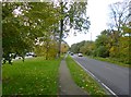
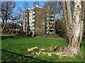
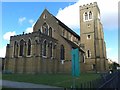
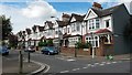
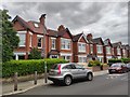
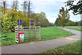
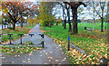
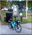
70 photos from this area
Area Information
Key information about the SW17 9BQ including its size, population, and administrative classification.
- Area Type
- Postcode
- Area Size
- 1.0 hectares
- Population
- 1746
- Population Density
- 8167 people/km²
House Prices in SW17 9BQ
37
Properties
£745,922
Average Sold Price
£92,000
Lowest Price
£1,475,000
Highest Price
Showing 37 properties
| Address | Type | Beds | Baths | Last Sale Price | Last Sale Date | |
|---|---|---|---|---|---|---|
| 27 Birchwood Road, London, SW17 9BQ | Terraced | 5 | 2 | £1,450,000 | Aug 2023 | |
| 14 Birchwood Road, London, SW17 9BQ | house | - | - | £1,365,000 | Mar 2022 | |
| 5 Birchwood Road, London, SW17 9BQ | Terraced | 4 | 2 | £1,100,000 | Jun 2021 | |
| 18 Birchwood Road, London, SW17 9BQ | Semi-detached | 4 | 2 | £1,252,000 | Oct 2020 | |
| 2 Birchwood Road, London, SW17 9BQ | Terraced | 6 | 6 | £1,475,000 | Mar 2019 | |
| 8 Birchwood Road, London, SW17 9BQ | Terraced | 5 | 2 | £1,285,000 | Jan 2016 | |
| 7 Birchwood Road, London, SW17 9BQ | Terraced | 3 | 2 | £740,000 | Jul 2014 | |
| 3 Birchwood Road, London, SW17 9BQ | house | - | - | £850,000 | Mar 2012 | |
| 12 Birchwood Road, London, SW17 9BQ | house | - | - | £845,000 | Aug 2011 | |
| 36 Birchwood Road, London, SW17 9BQ | house | 4 | - | £495,000 | Jun 2010 |
Page 1 of 4
Energy Efficiency in SW17 9BQ
Amenities
Schools
| Rank | School | Type | Entry gender | Ages |
|---|
Explore more schools in this area
Go to Schools tabDemographics
Household Size
Family (3-5 people)
most common
Accommodation Type
Houses
most common
Tenure
75
majority
Ethnic Group
White
most common
Religion
N/A
most common
Household Composition
N/A
most common
Age
47
median
Adults (30-64 years)
most common
Household Deprivation
N/A
with no deprivation
NS-SEC
42
in Lower managerial occupations
Explore more demographic insights in this area
Go to Demographics tabPlanning
Planning Constraints
- Flood RiskPremium
- Ramsar Wetland SitesPremium
- Area of Outstanding Natural BeautyPremium
- Protected Nature ReservePremium
- Protected WoodlandPremium