Area Overview for SW17 8NY
Photos of SW17 8NY
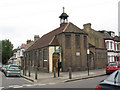
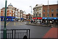
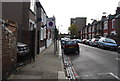
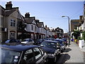
100 photos from this area
Area Information
Key information about the SW17 8NY including its size, population, and administrative classification.
- Area Type
- Postcode
- Area Size
- 5236 m²
- Population
- 1763
- Population Density
- 20382 people/km²
House Prices in SW17 8NY
58
Properties
£382,646
Average Sold Price
£45,000
Lowest Price
£683,200
Highest Price
Showing 58 properties
| Address | Type | Beds | Baths | Last Sale Price | Last Sale Date | |
|---|---|---|---|---|---|---|
| 146 Coteford Street, London, SW17 8NY | Terraced | 2 | 1 | £527,500 | Oct 2025 | |
| 126 Coteford Street, London, SW17 8NY | Terraced | 2 | 1 | £530,000 | Mar 2025 | |
| 38 Coteford Street, London, SW17 8NY | Terraced | 2 | 1 | £485,000 | Mar 2025 | |
| 102 Coteford Street, London, SW17 8NY | Terraced | 2 | 1 | £495,000 | Mar 2025 | |
| 94 Coteford Street, London, SW17 8NY | Terraced | 2 | 1 | £536,000 | Mar 2025 | |
| 74 Coteford Street, London, SW17 8NY | Terraced | 2 | 1 | £683,200 | Dec 2024 | |
| 62 Coteford Street, London, SW17 8NY | Terraced | 2 | 1 | £540,000 | Jul 2024 | |
| 80 Coteford Street, London, SW17 8NY | Terraced | 2 | 1 | £450,000 | Feb 2024 | |
| 128 Coteford Street, London, SW17 8NY | Detached | 2 | 1 | £500,000 | Nov 2023 | |
| 72 Coteford Street, London, SW17 8NY | Terraced | 2 | 1 | £555,000 | Nov 2023 |
Page 1 of 6
Energy Efficiency in SW17 8NY
Amenities
Schools
| Rank | School | Type | Entry gender | Ages |
|---|
Explore more schools in this area
Go to Schools tabDemographics
Household Size
Family (3-5 people)
most common
Accommodation Type
Houses
most common
Tenure
47
majority
Ethnic Group
White
most common
Religion
N/A
most common
Household Composition
N/A
most common
Age
47
median
Adults (30-64 years)
most common
Household Deprivation
N/A
with no deprivation
NS-SEC
45
in Lower managerial occupations
Explore more demographic insights in this area
Go to Demographics tabPlanning
Planning Constraints
- Flood RiskPremium
- Ramsar Wetland SitesPremium
- Area of Outstanding Natural BeautyPremium
- Protected Nature ReservePremium
- Protected WoodlandPremium