Area Overview for SW16 6PD
Photos of SW16 6PD
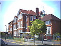

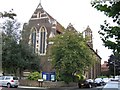
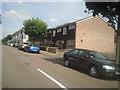
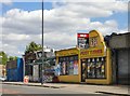


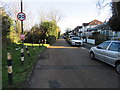
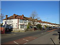
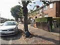
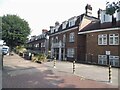
63 photos from this area
Area Information
Key information about the SW16 6PD including its size, population, and administrative classification.
- Area Type
- Postcode
- Area Size
- 1.8 hectares
- Population
- Not available
- Population Density
- Not available
House Prices in SW16 6PD
34
Properties
£374,361
Average Sold Price
£87,000
Lowest Price
£800,000
Highest Price
Showing 34 properties
| Address | Type | Beds | Baths | Last Sale Price | Last Sale Date | |
|---|---|---|---|---|---|---|
| 14 Rustic Avenue, Streatham, London, SW16 6PD | Semi-detached | 4 | 1 | £700,000 | Mar 2025 | |
| 20 Rustic Avenue, Streatham, London, SW16 6PD | house | - | - | £635,000 | Apr 2024 | |
| 12 Rustic Avenue, Streatham, London, SW16 6PD | Terraced | 1 | 2 | £800,000 | Mar 2021 | |
| 22 Rustic Avenue, Streatham, London, SW16 6PD | house | 3 | - | £715,000 | Mar 2021 | |
| 27 Rustic Avenue, Streatham, London, SW16 6PD | Terraced | 3 | - | £458,000 | Apr 2017 | |
| 11 Rustic Avenue, Streatham, London, SW16 6PD | Terraced | 3 | - | £600,000 | Jul 2015 | |
| 8 Rustic Avenue, Streatham, London, SW16 6PD | Terraced | 3 | - | £400,000 | Jun 2013 | |
| 9 Rustic Avenue, Streatham, London, SW16 6PD | house | 4 | - | £359,000 | Jul 2011 | |
| 16 Rustic Avenue, Streatham, London, SW16 6PD | Semi-detached | 6 | 2 | £175,000 | Mar 2008 | |
| 10 Rustic Avenue, Streatham, London, SW16 6PD | Terraced | - | - | £340,000 | Mar 2008 |
Page 1 of 4
Energy Efficiency in SW16 6PD
Amenities
Schools
| Rank | School | Type | Entry gender | Ages |
|---|
Explore more schools in this area
Go to Schools tabDemographics
Household Size
Family (3-5 people)
most common
Accommodation Type
Houses
most common
Tenure
61
majority
Ethnic Group
White
most common
Religion
N/A
most common
Household Composition
N/A
most common
Age
47
median
Adults (30-64 years)
most common
Household Deprivation
N/A
with no deprivation
NS-SEC
35
in Lower managerial occupations
Explore more demographic insights in this area
Go to Demographics tabPlanning
Planning Constraints
- Flood RiskPremium
- Ramsar Wetland SitesPremium
- Area of Outstanding Natural BeautyPremium
- Protected Nature ReservePremium
- Protected WoodlandPremium