Area Overview for SW16 5TD
Photos of SW16 5TD
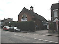
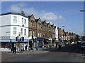
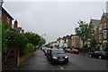
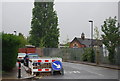
98 photos from this area
Area Information
Key information about the SW16 5TD including its size, population, and administrative classification.
- Area Type
- Postcode
- Area Size
- 8590 m²
- Population
- 1529
- Population Density
- 11983 people/km²
House Prices in SW16 5TD
49
Properties
£304,554
Average Sold Price
£66,000
Lowest Price
£600,000
Highest Price
Showing 49 properties
| Address | Type | Beds | Baths | Last Sale Price | Last Sale Date | |
|---|---|---|---|---|---|---|
| 58 Streatham Vale, London, SW16 5TD | Terraced | 3 | 1 | £565,000 | Apr 2025 | |
| 56 Streatham Vale, London, SW16 5TD | Terraced | 3 | 1 | £585,000 | Mar 2025 | |
| 86 Streatham Vale, London, SW16 5TD | house | 3 | 1 | £600,000 | Mar 2025 | |
| 84 Streatham Vale, London, SW16 5TD | house | - | - | £555,000 | Mar 2025 | |
| 82 Streatham Vale, London, SW16 5TD | house | - | - | £340,000 | Feb 2024 | |
| 92 Streatham Vale, London, SW16 5TD | house | 4 | 2 | £570,000 | Jul 2022 | |
| 88 Streatham Vale, London, SW16 5TD | Terraced | 3 | 1 | £526,000 | Feb 2022 | |
| 48 Streatham Vale, London, SW16 5TD | house | - | - | £535,000 | May 2021 | |
| 90 Streatham Vale, London, SW16 5TD | Terraced | 4 | 3 | £550,000 | Nov 2016 | |
| 38 Streatham Vale, London, SW16 5TD | house | - | - | £332,500 | Nov 2013 |
Page 1 of 5
Energy Efficiency in SW16 5TD
Amenities
Schools
| Rank | School | Type | Entry gender | Ages |
|---|
Explore more schools in this area
Go to Schools tabDemographics
Household Size
Family (3-5 people)
most common
Accommodation Type
Houses
most common
Tenure
59
majority
Ethnic Group
White
most common
Religion
N/A
most common
Household Composition
N/A
most common
Age
47
median
Adults (30-64 years)
most common
Household Deprivation
N/A
with no deprivation
NS-SEC
33
in Lower managerial occupations
Explore more demographic insights in this area
Go to Demographics tabPlanning
Planning Constraints
- Flood RiskPremium
- Ramsar Wetland SitesPremium
- Area of Outstanding Natural BeautyPremium
- Protected Nature ReservePremium
- Protected WoodlandPremium