Area Overview for SW16 5DU
Photos of SW16 5DU
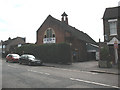
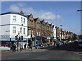
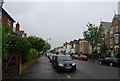
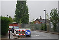
98 photos from this area
Area Information
Key information about the SW16 5DU including its size, population, and administrative classification.
- Area Type
- Postcode
- Area Size
- 4619 m²
- Population
- 1529
- Population Density
- 11983 people/km²
House Prices in SW16 5DU
27
Properties
£309,600
Average Sold Price
£99,000
Lowest Price
£577,500
Highest Price
Showing 27 properties
| Address | Type | Beds | Baths | Last Sale Price | Last Sale Date | |
|---|---|---|---|---|---|---|
| 62 Glenister Park Road, London, SW16 5DU | Terraced | 1 | 1 | £577,500 | Apr 2025 | |
| 76 Glenister Park Road, London, SW16 5DU | Terraced | 3 | 1 | £515,000 | Nov 2023 | |
| 88 Glenister Park Road, London, SW16 5DU | Terraced | 5 | 2 | £448,000 | Jun 2023 | |
| 60 Glenister Park Road, London, SW16 5DU | Terraced | 4 | - | £560,000 | Aug 2022 | |
| 84 Glenister Park Road, London, SW16 5DU | house | - | - | £475,000 | Mar 2021 | |
| 64 Glenister Park Road, London, SW16 5DU | Terraced | - | - | £210,000 | Feb 2009 | |
| 74 Glenister Park Road, London, SW16 5DU | Flat | 2 | - | £245,000 | Sep 2008 | |
| 94 Glenister Park Road, London, SW16 5DU | house | - | - | £255,000 | Nov 2007 | |
| 72 Glenister Park Road, London, SW16 5DU | house | - | - | £227,500 | Oct 2006 | |
| 80 Glenister Park Road, London, SW16 5DU | Terraced | 4 | 2 | £205,000 | May 2006 |
Page 1 of 3
Energy Efficiency in SW16 5DU
Amenities
Schools
| Rank | School | Type | Entry gender | Ages |
|---|
Explore more schools in this area
Go to Schools tabDemographics
Household Size
Family (3-5 people)
most common
Accommodation Type
Houses
most common
Tenure
59
majority
Ethnic Group
White
most common
Religion
N/A
most common
Household Composition
N/A
most common
Age
47
median
Adults (30-64 years)
most common
Household Deprivation
N/A
with no deprivation
NS-SEC
33
in Lower managerial occupations
Explore more demographic insights in this area
Go to Demographics tabPlanning
Planning Constraints
- Flood RiskPremium
- Ramsar Wetland SitesPremium
- Area of Outstanding Natural BeautyPremium
- Protected Nature ReservePremium
- Protected WoodlandPremium