Area Overview for SM5 2RU
Photos of SM5 2RU
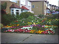
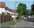
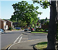
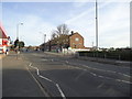
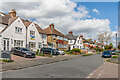

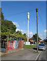
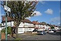
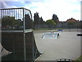

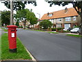
40 photos from this area
Area Information
Key information about the SM5 2RU including its size, population, and administrative classification.
- Area Type
- Postcode
- Area Size
- 4141 m²
- Population
- 1632
- Population Density
- 9957 people/km²
House Prices in SM5 2RU
12
Properties
£331,000
Average Sold Price
£242,000
Lowest Price
£420,000
Highest Price
Showing 12 properties
| Address | Type | Beds | Baths | Last Sale Price | Last Sale Date | |
|---|---|---|---|---|---|---|
| 145 Wrythe Lane, Carshalton, SM5 2RU | house | - | - | £420,000 | Jan 2022 | |
| 141 Wrythe Lane, Carshalton, SM5 2RU | house | - | - | £242,000 | Oct 2007 | |
| Shell Recharge, Electric Vehicle Charging Points, St Heliers Service Station, 123-125 Wrythe Lane, Carshalton, SM5 2RU | Retail | - | - | - | - | |
| Amazon Hub, Electronic Delivery Locker, St Heliers Service Station, 123-125 Wrythe Lane, Carshalton, SM5 2RU | Retail | - | - | - | - | |
| First Floor Flat, 131 Wrythe Lane, Carshalton, SM5 2RU | Flat | - | - | - | - | |
| Top Floor Flat, 131 Wrythe Lane, Carshalton, SM5 2RU | Flat | - | - | - | - | |
| 129B Wrythe Lane, Carshalton, SM5 2RU | Flat | - | - | - | - | |
| Shop, St Heliers Service Station, 123-125 Wrythe Lane, Carshalton, SM5 2RU | shop | - | - | - | - | |
| Flat Above, 133 Wrythe Lane, Carshalton, SM5 2RU | Flat | - | - | - | - | |
| 143 Wrythe Lane, Carshalton, SM5 2RU | Terraced | - | - | - | - |
Page 1 of 2
Energy Efficiency in SM5 2RU
Amenities
Schools
| Rank | School | Type | Entry gender | Ages |
|---|
Explore more schools in this area
Go to Schools tabDemographics
Household Size
Family (3-5 people)
most common
Accommodation Type
Houses
most common
Tenure
45
majority
Ethnic Group
White
most common
Religion
N/A
most common
Household Composition
N/A
most common
Age
47
median
Adults (30-64 years)
most common
Household Deprivation
N/A
with no deprivation
NS-SEC
25
in Lower managerial occupations
Explore more demographic insights in this area
Go to Demographics tabPlanning
Planning Constraints
- Flood RiskPremium
- Ramsar Wetland SitesPremium
- Area of Outstanding Natural BeautyPremium
- Protected Nature ReservePremium
- Protected WoodlandPremium