Area Overview for SM1 4EY
Photos of SM1 4EY

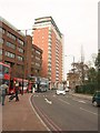
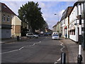
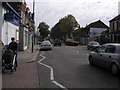
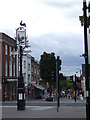
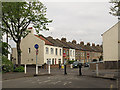
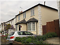

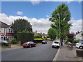

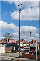
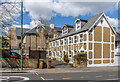
54 photos from this area
Area Information
Key information about the SM1 4EY including its size, population, and administrative classification.
- Area Type
- Postcode
- Area Size
- 951 m²
- Population
- 1542
- Population Density
- 9974 people/km²
House Prices in SM1 4EY
8
Properties
£179,625
Average Sold Price
£62,000
Lowest Price
£302,000
Highest Price
Showing 8 properties
| Address | Type | Beds | Baths | Last Sale Price | Last Sale Date | |
|---|---|---|---|---|---|---|
| 11 Turnpike Lane, Sutton, SM1 4EY | Flat | 1 | 1 | £173,000 | Oct 2025 | |
| 16 Turnpike Lane, Sutton, SM1 4EY | Retail | 1 | - | £302,000 | May 2022 | |
| 15 Turnpike Lane, Sutton, SM1 4EY | Semi-detached | 1 | 1 | £256,000 | Nov 2015 | |
| 12 Turnpike Lane, Sutton, SM1 4EY | Terraced | 1 | 1 | £275,000 | Apr 2014 | |
| 18 Turnpike Lane, Sutton, SM1 4EY | house | 1 | 1 | £170,000 | Aug 2012 | |
| 13 Turnpike Lane, Sutton, SM1 4EY | Terraced | - | - | £128,000 | Jun 2001 | |
| 17 Turnpike Lane, Sutton, SM1 4EY | Terraced | - | - | £71,000 | Jun 1999 | |
| 14 Turnpike Lane, Sutton, SM1 4EY | Terraced | - | - | £62,000 | Mar 1995 |
Energy Efficiency in SM1 4EY
Amenities
Schools
| Rank | School | Type | Entry gender | Ages |
|---|
Explore more schools in this area
Go to Schools tabDemographics
Household Size
Family (3-5 people)
most common
Accommodation Type
Houses
most common
Tenure
60
majority
Ethnic Group
White
most common
Religion
N/A
most common
Household Composition
N/A
most common
Age
47
median
Adults (30-64 years)
most common
Household Deprivation
N/A
with no deprivation
NS-SEC
41
in Lower managerial occupations
Explore more demographic insights in this area
Go to Demographics tabPlanning
Planning Constraints
- Flood RiskPremium
- Ramsar Wetland SitesPremium
- Area of Outstanding Natural BeautyPremium
- Protected Nature ReservePremium
- Protected WoodlandPremium