Area Overview for SM1 3SU
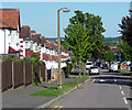
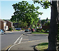
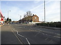
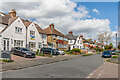
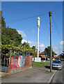
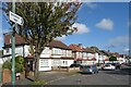
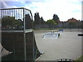
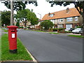
Photos of SM1 3SU


Area Information
SM1 3SU represents a specific residential cluster containing just 1.5 hectares of land. This small footprint supports a population of 1,862 people, creating an environment defined by density rather than vast open spaces. The location functions as a tightly knit neighbourhood where daily life revolves around shared local resources and a compact community atmosphere. Living in SM1 3SU means you operate within a defined boundary that prioritises convenience and proximity to urban amenities. The area lacks the sprawling characteristics of larger districts, which fosters a distinct sense of locality among its 1,862 residents. You are situated in a place where every journey to a shop or transport hub is short and direct. The high population density of 125,390 people per square kilometre indicates a built-up urban setting typical of Greater London. This concentration results in efficient service coverage and a vibrant street life, though it also means limited green space. Residents of this postcode find themselves surrounded by established housing stock rather than new developments. The area serves as a functional part of the broader Colliers Wood and Sutton landscape, where practicality and accessibility take precedence over expansive grounds.
- Area Type
- Postcode
- Area Size
- 1.5 hectares
- Population
- 1862
- Population Density
- 6795 people/km²
Homes in SM1 3SU are characterised by a strong tradition of ownership within a high-density environment. The accommodation type is exclusively flats, which defines the housing stock across this 1.5 hectare area. With a home ownership level of 69%, the majority of residents are owner-occupiers rather than tenants. This statistic confirms that the local market is driven by buying and selling confirmed deals rather than a transient rental sector. When looking at flats for sale or rent now, you are likely dealing with a mature estate where many units have changed hands over several owner-occupiers. This stability often translates to well-maintained building facades and managed communal areas. The dominance of flats suggests a property type suited to professionals, down-sizers, or dual-income households seeking convenience in central London. You do not find terraced houses or detached properties in this specific postcode cluster. The 69% ownership figure provides a clear indicator that the area is financially secure enough to support significant mortgage activity. Buyers entering this market can expect a community where property values are established and consistent with the local flat market.
House Prices in SM1 3SU
Showing 69 properties
| Address | Type | Beds | Baths | Last Sale Price | Last Sale Date | |
|---|---|---|---|---|---|---|
| 10 Woodside Road, Sutton, SM1 3SU | Semi-detached | 3 | 1 | £554,000 | Aug 2024 | |
| 8 Woodside Road, Sutton, SM1 3SU | house | - | - | £550,000 | Feb 2021 | |
| 30 Woodside Road, Sutton, SM1 3SU | Flat | - | - | £316,000 | Jan 2021 | |
| 30A Woodside Road, Sutton, SM1 3SU | Maisonette | 2 | 1 | £285,000 | Jun 2019 | |
| 24 Woodside Road, Sutton, SM1 3SU | Semi-detached | 4 | 2 | £500,000 | Mar 2017 | |
| 5B Woodside Road, Sutton, SM1 3SU | Bungalow | 1 | 1 | £298,000 | Mar 2017 | |
| 34A Woodside Road, Sutton, SM1 3SU | Maisonette | 2 | 1 | £223,000 | Jul 2015 | |
| 20 Woodside Road, Sutton, SM1 3SU | house | - | - | £395,000 | Feb 2015 | |
| 2A Woodside Road, Sutton, SM1 3SU | house | - | - | £385,000 | Apr 2014 | |
| 2 Woodside Road, Sutton, SM1 3SU | house | 3 | - | £345,000 | Jun 2013 |
Energy Efficiency in SM1 3SU
Residents of SM1 3SU enjoy exceptional access to retail, rail, metro, and ferry services within practical reach. Five notable retail options include Lidl London, Sainsburys Sutton, and Tesco Angel, ensuring you have choices for groceries and daily goods. The area boasts five rail stations nearby, specifically Sutton Common Station, West Sutton, and Carshalton Station, providing direct train links across London. Public transport is further enhanced by five metro stops including Mitcham Tram Stop, Belgrave Walk Tram Stop, and Morden. For historic access, two ferry terminals are available at Kingston Town End Pier and Kingston Turks Pier. This dense network of amenities means you rarely need a car for daily errands. Shopping trips are quick, whether you prefer the discount range of Lidl or the full service of Tesco Angel. You can catch a tram to Victoria or a train to London Waterloo with minimal delay. The variety of transport modes gives you flexibility for commuting or leisure travel on weekends. Every essential service lies within a short walk or quick journey from your home.
Amenities
Schools
You will find excellent educational provision immediately nearby within SM1 3SU. All Saints Benhilton CofE Primary School stands as the key educational facility serving the area. The school holds an Ofsted rating of good, reflecting consistent standards in teaching and student outcomes for primary education. As a Church of England institution, it offers a specific ethos that some families actively seek for their children. This primary school rating gives confidence regarding the quality of local education without the need for long commutes to catchment zones further away. The presence of a good-rated school implies that families with young children can access quality instruction from their homes in the flats. While there are no secondary schools listed in the immediate vicinity for SM1 3SU, the primary option ensures early childhood development stays local. Parents residing here benefit from a school that meets the government's high standards for curriculum and pastoral care. The accessibility of All Saints Benhilton CofE Primary School makes it a central factor in the decision to live in this postcode.
| Rank | School | Type | Entry gender | Ages |
|---|
Explore more schools in this area
Go to Schools tabDemographics
The community in SM1 3SU reflects a mature demographic profile with a median age of 47 years. Adults between the ages of 30 and 64 years constitute the most common age range, suggesting a stable population of established households. This age distribution aligns with a high home ownership rate of 69%, indicating that most residents have purchased their properties rather than renting. The dominant accommodation type is flats, which suits the urban nature of the 1.5 hectare plot and appeals to those seeking low-maintenance living in a dense setting. Predominantly, the population is White, mirroring the broader demographic makeup of the surrounding suburbs. With almost two-thirds of the 1,862 residents owning their homes, the area feels settled and family-oriented in many cases. The higher median age compared to the national average points to a neighbourhood where children have grown up and young families may be returning or downsizing. You will find a community accustomed to long-term residency, where neighbours often know each other through decades of shared history within the flats.
Household Size
Accommodation Type
Tenure
Ethnic Group
Religion
Household Composition
Age
Household Deprivation
NS-SEC
Explore more demographic insights in this area
Go to Demographics tabPlanning
Planning Constraints
- Flood RiskPremium
- Ramsar Wetland SitesPremium
- Area of Outstanding Natural BeautyPremium
- Protected Nature ReservePremium
- Protected WoodlandPremium