Area Overview for SM1 3ST
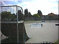
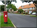
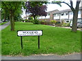
Photos of SM1 3ST


Area Information
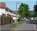
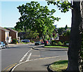
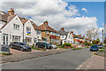
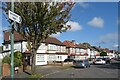
Living in SM1 3ST offers a settled residential experience within a compact postcode area measuring 4144 square metres. A total of 1862 residents call this specific cluster home, creating a close-knit environment that avoids the sprawl of larger suburban districts. You will find a demographic leaning heavily towards adults, as the median age sits at 47 years with most residents falling between 30 and 64 years old. This suggests a neighbourhood populated by established families and professionals who have put down roots rather than transient students or young commuters. The population density reflects a focused community where daily interactions remain personal yet balanced by adequate space. Daily life here is defined by practical convenience rather than tourist appeal. Residents navigate a mix of residential streets that support a standard British neighbourhood pace. You do not need to travel far to access essential services, as high-quality retail and transport options line the immediate perimeter. The area functions as a quiet retreat where the primary focus remains on the quality of domestic life. Whether you are looking for homes in SM1 3ST or evaluating the suitability of living in SM1 3ST, the data points to a stable, mature community. The small area size ensures that noise and traffic congestion remain contained, preserving the exclusivity of your home environment without isolating you from local amenities.
- Area Type
- Postcode
- Area Size
- 4144 m²
- Population
- 1862
- Population Density
- 6795 people/km²
The property landscape in SM1 3ST is defined by a significant owner-occupier presence. Almost 70% of the housing stock is owned outright or with a mortgage, meaning the majority of transactions here are purchases rather than short-term lets. Flats constitute the main accommodation type, indicating that buyers should look for two- or three-bedroom apartments, possibly within converted buildings or modern developments. This mix suggests the area suits couples, empty nesters, or small families requiring flexible layouts rather than large detached houses. Because the postcode covers a smaller residential cluster, supply is limited compared to broader boroughs. You will find a market driven by local sellers looking to upgrade or downsize rather than national investors flipping units weekly. The high homeownership rate implies that land prices may reflect the value of the home itself rather than speculative potential. When searching for homes in SM1 3ST, inspectors and buyers should focus on flats that offer good space per square metre. The lack of rental data implies a stable long-term market where relationships between tenants and landlords tend to last for years. This stability benefits both buyers seeking security and sellers looking for reliable returns without the volatility of the wider rental sector.
House Prices in SM1 3ST
Showing 10 properties
| Address | Type | Beds | Baths | Last Sale Price | Last Sale Date | |
|---|---|---|---|---|---|---|
| 9, Benhilton Court, 87 Benhill Wood Road, Sutton, SM1 3ST | Flat | 4 | 2 | - | - | |
| 10, Benhilton Court, 87 Benhill Wood Road, Sutton, SM1 3ST | Flat | 4 | 2 | - | - | |
| 7, Benhilton Court, 87 Benhill Wood Road, Sutton, SM1 3ST | Maisonette | 4 | 2 | - | - | |
| 1, Benhilton Court, 87 Benhill Wood Road, Sutton, SM1 3ST | Maisonette | 3 | - | - | - | |
| 3, Benhilton Court, 87 Benhill Wood Road, Sutton, SM1 3ST | Flat | - | - | - | - | |
| 2, Benhilton Court, 87 Benhill Wood Road, Sutton, SM1 3ST | Flat | - | - | - | - | |
| 6, Benhilton Court, 87 Benhill Wood Road, Sutton, SM1 3ST | Maisonette | - | - | - | - | |
| 5, Benhilton Court, 87 Benhill Wood Road, Sutton, SM1 3ST | Flat | - | - | - | - | |
| 8, Benhilton Court, 87 Benhill Wood Road, Sutton, SM1 3ST | Flat | - | - | - | - | |
| 4, Benhilton Court, 87 Benhill Wood Road, Sutton, SM1 3ST | Flat | - | - | - | - |
Energy Efficiency in SM1 3ST
Your daily life in SM1 3ST benefits from a diverse range of amenities located just outside the immediate residential cluster. For shopping needs, five major retailers are easily accessible, including Tesco Angel, Lidl London, and Sainsburys Sutton. These supermarket chains provide everything from supermarket essentials to fresh produce without requiring a long drive. Rail commuters have five options at hand, with Sutton Common Station and West Sutton serving as key interchange points for train journeys. Travelers by tram or ferry also have access to five and two respective stops, including Morden and Kingstons piers, ensuring comprehensive transport coverage. Leisure and family activities are supported by a mix of modern and traditional facilities. While you have noted retail options, you should also explore parks and leisure centres in the surrounding boroughs, as the data specifically lists transport and retail hubs rather than green spaces within the 4144 square metre area. The presence of a tram stop and ferry access indicates a well-connected lifestyle where you can easily reach cultural sites in Sutton or Merton. You will find that living in SM1 3ST offers a balance of quiet home life and vibrant local shopping. This combination appeals to those who value convenience and do not wish to spend hours commuting to city centres for everyday errands.
Amenities
Schools
Families residing in or considering SM1 3ST have access to specific educational institutions nearby. All Saints Benhilton CofE Primary School stands as the nearest option for younger children. This primary school holds a 'good' Ofsted rating, confirming it meets the required standards for education and care. As a Church of England school, it follows a faith-based curriculum while adhering to national educational frameworks. The presence of a rated primary school suggests the area supports families with young children who may not be ready for secondary education yet. Currently, the data does not list secondary schools or further education colleges within the immediate vicinity. This means residents likely rely on transport links to reach secondary institutions in broader zones such as Sutton or Merton. The 'good' rating of All Saints Benhilton CofE Primary School provides reassurance for parents navigating the school placement process. When evaluating schools near SM1 3ST, this specific primary venue offers a known quantity for those prioritising quality education for their offspring. You do not have extensive data on exam results or league table rankings for upper school years, so initial focus remains on the quality and proximity of the primary provision.
| Rank | School | Type | Entry gender | Ages |
|---|
Explore more schools in this area
Go to Schools tabDemographics
The community profile of SM1 3ST is distinctly mature and established. With a median age of 47, the area attracts adults aged between 30 and 64 years as the most common age range. This demographic skew indicates a shift away from family nesting with young children towards households in their earning and parenting prime. Approximately 69% of residents own their homes, suggesting a strong sense of local ownership and stability within the neighbourhood. This high homeownership rate often correlates with long-term residents who have invested in their properties and are less likely to move frequently. Ethnically, White residents form the predominant group, reflecting the traditional character of many settlements in the Outer London suburbs. The primary accommodation type listed for this postcode is flats, which presents an interesting contrast to the high homeownership figure. You might find converted Victorian terraces adapted into flats or purpose-built blocks catering to couples and small families. There is no data provided on deprivation levels, so you must rely on other factors like employment stability and school choice to gauge living standards. The low population figure of 1862 reinforces that this is a local area rather than a mass transit hub, appealing to those who seek a specific residential vibe over urban anonymity.
Household Size
Accommodation Type
Tenure
Ethnic Group
Religion
Household Composition
Age
Household Deprivation
NS-SEC
Explore more demographic insights in this area
Go to Demographics tabPlanning
Planning Constraints
- Flood RiskPremium
- Ramsar Wetland SitesPremium
- Area of Outstanding Natural BeautyPremium
- Protected Nature ReservePremium
- Protected WoodlandPremium