Area Overview for SM1 3LE
Photos of SM1 3LE
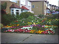
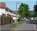
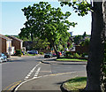
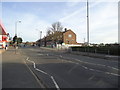
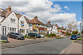
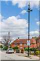
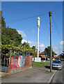
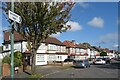
40 photos from this area
Area Information
Key information about the SM1 3LE including its size, population, and administrative classification.
- Area Type
- Postcode
- Area Size
- 1.4 hectares
- Population
- 1770
- Population Density
- 4349 people/km²
House Prices in SM1 3LE
19
Properties
£515,495
Average Sold Price
£179,995
Lowest Price
£885,000
Highest Price
Showing 19 properties
| Address | Type | Beds | Baths | Last Sale Price | Last Sale Date | |
|---|---|---|---|---|---|---|
| 16 Aultone Way, Sutton, SM1 3LE | Bungalow | 4 | 3 | £885,000 | Dec 2022 | |
| 14 Aultone Way, Sutton, SM1 3LE | Maisonette | 1 | 1 | £671,000 | May 2022 | |
| 22 Aultone Way, Sutton, SM1 3LE | house | - | - | £630,000 | Sep 2021 | |
| 26 Aultone Way, Sutton, SM1 3LE | Semi-detached | 4 | 3 | £615,000 | Aug 2018 | |
| 8 Aultone Way, Sutton, SM1 3LE | Bungalow | 4 | 2 | £682,000 | Apr 2018 | |
| 6 Aultone Way, Sutton, SM1 3LE | Bungalow | 4 | 2 | £640,000 | Aug 2016 | |
| 28 Aultone Way, Sutton, SM1 3LE | Semi-detached | 5 | 2 | £600,000 | Aug 2016 | |
| 20A Aultone Way, Sutton, SM1 3LE | Bungalow | - | - | £515,000 | May 2016 | |
| 34 Aultone Way, Sutton, SM1 3LE | Semi-detached | 4 | 2 | £495,000 | Feb 2016 | |
| 18 Aultone Way, Sutton, SM1 3LE | Detached | 4 | - | £425,000 | Oct 2011 |
Page 1 of 2
Energy Efficiency in SM1 3LE
Amenities
Schools
| Rank | School | Type | Entry gender | Ages |
|---|
Explore more schools in this area
Go to Schools tabDemographics
Household Size
Family (3-5 people)
most common
Accommodation Type
Houses
most common
Tenure
83
majority
Ethnic Group
White
most common
Religion
N/A
most common
Household Composition
N/A
most common
Age
47
median
Adults (30-64 years)
most common
Household Deprivation
N/A
with no deprivation
NS-SEC
40
in Lower managerial occupations
Explore more demographic insights in this area
Go to Demographics tabPlanning
Planning Constraints
- Flood RiskPremium
- Ramsar Wetland SitesPremium
- Area of Outstanding Natural BeautyPremium
- Protected Nature ReservePremium
- Protected WoodlandPremium