Area Overview for SM1 3EU
Photos of SM1 3EU
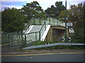
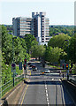


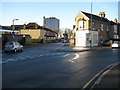

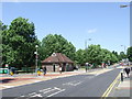
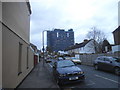
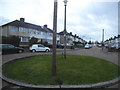
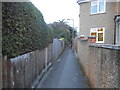
64 photos from this area
Area Information
Key information about the SM1 3EU including its size, population, and administrative classification.
- Area Type
- Postcode
- Area Size
- 6586 m²
- Population
- 1770
- Population Density
- 4349 people/km²
House Prices in SM1 3EU
40
Properties
£200,500
Average Sold Price
£110,000
Lowest Price
£520,000
Highest Price
Showing 40 properties
| Address | Type | Beds | Baths | Last Sale Price | Last Sale Date | |
|---|---|---|---|---|---|---|
| 22 Rose Hill, Sutton, SM1 3EU | Flat | 1 | - | £172,000 | Apr 2024 | |
| 10 Rose Hill, Sutton, SM1 3EU | Flat | - | - | £235,000 | Feb 2023 | |
| 26 Rose Hill, Sutton, SM1 3EU | Flat | - | - | £110,000 | May 2014 | |
| 20 Rose Hill, Sutton, SM1 3EU | Flat | - | - | £120,000 | May 2014 | |
| 14 Rose Hill, Sutton, SM1 3EU | Flat | - | - | £146,500 | Aug 2007 | |
| 16 Rose Hill, Sutton, SM1 3EU | Flat | 1 | - | £137,500 | Feb 2007 | |
| 46 Rose Hill, Sutton, SM1 3EU | Semi-detached | - | - | £330,000 | Nov 2005 | |
| Ashling Tara Hotel, 50 Rose Hill, Sutton, SM1 3EU | house | - | - | £520,000 | Sep 2005 | |
| 40 Rose Hill, Sutton, SM1 3EU | Flat | - | - | £110,000 | Dec 2003 | |
| 28 Rose Hill, Sutton, SM1 3EU | Flat | - | - | £120,000 | Jul 2003 |
Page 1 of 4
Energy Efficiency in SM1 3EU
Amenities
Schools
| Rank | School | Type | Entry gender | Ages |
|---|
Explore more schools in this area
Go to Schools tabDemographics
Household Size
Family (3-5 people)
most common
Accommodation Type
Houses
most common
Tenure
83
majority
Ethnic Group
White
most common
Religion
N/A
most common
Household Composition
N/A
most common
Age
47
median
Adults (30-64 years)
most common
Household Deprivation
N/A
with no deprivation
NS-SEC
40
in Lower managerial occupations
Explore more demographic insights in this area
Go to Demographics tabPlanning
Planning Constraints
- Flood RiskPremium
- Ramsar Wetland SitesPremium
- Area of Outstanding Natural BeautyPremium
- Protected Nature ReservePremium
- Protected WoodlandPremium