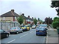
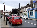
Area Overview for SE9 2UG
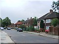
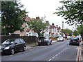
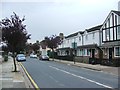
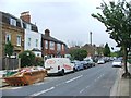
Photos of SE9 2UG


Area Information
Living in SE9 2UG means residing in a compact residential cluster covering just 1.7 hectares within the larger Eltham Town and Avery Hill ward. This postcode area houses 2,478 people, creating a tightly knit environment where community interactions are frequent. The location sits in southeast London, approximately 8.7 miles east-southeast of Charing Cross, placing it firmly within the Royal Borough of Greenwich. While the immediate cluster is small, it connects to a broader suburban landscape that retains significant open green spaces. Human activity in these grounds dates back to the Mesolithic period, with local history marked by the ancient 'Eald Ham' recorded in the Domesday Book. The area evolved from farms into the expansive Avery Hill estate, featuring a historic mansion and site now known as Avery Hill College of Education. Today, the setting balances urban convenience with the tranquil character of a garden suburb. You enjoy proximity to London City Airport and the River Thames, yet you remain removed from the busiest city centres. This blend allows residents to access major transport links while stepping into an environment defined by heritage and nature.
- Area Type
- Postcode
- Area Size
- 1.7 hectares
- Population
- 2478
- Population Density
- 3568 people/km²
The property market in SE9 2UG is characterised by a dominance of flats rather than detached or semi-detached homes. This suggests a housing stock geared towards higher-density living, typical of London's expanding suburbs. With only 35% home ownership rates, the area likely presents a mixture of rental units and first-time buyer purchases. You will find that most properties are built to accommodate smaller families or individuals rather than multi-generational households. Given the area's specific size of 1.7 hectares, you are looking at a contained residential zone likely comprising estate developments rather than sprawling single-family streets. The 2,478 recorded population spread across this footprint indicates a demand for efficient use of space. Buyers should note that the accommodation type largely excludes traditional houses, which are more common in wider Eltham wards but absent from this specific postcode definition. This focus on flats makes the neighbourhood attractive for those who value proximity to transport and amenities over private outdoor space. The market reflects a practical approach to living in southeast London, prioritising access and convenience over luxury estates.
House Prices in SE9 2UG
Showing 7 properties
| Address | Type | Beds | Baths | Last Sale Price | Last Sale Date | |
|---|---|---|---|---|---|---|
| University Of Greenwich, David Fussey Building, Avery Hill Campus, Avery Hill Road, Avery Hill, SE9 2UG | studentAccommodation | - | - | - | - | |
| University Of Greenwich, Lady Jane Grey House, Avery Hill Campus, Avery Hill Road, Avery Hill, SE9 2UG | studentAccommodation | - | - | - | - | |
| University Of Greenwich, Southwood House, Avery Hill Campus, Avery Hill Road, Avery Hill, SE9 2UG | Office | - | - | - | - | |
| University Of Greenwich, Charlotte Bronte House, Avery Hill Campus, Avery Hill Road, Avery Hill, SE9 2UG | studentAccommodation | - | - | - | - | |
| University Of Greenwich, Elizabeth Fry House, Avery Hill Campus, Avery Hill Road, Avery Hill, SE9 2UG | studentAccommodation | - | - | - | - | |
| University Of Greenwich, Mary Seacole Building, Avery Hill Campus, Avery Hill Road, Avery Hill, SE9 2UG | studentAccommodation | - | - | - | - | |
| University Of Greenwich, Southwood Lodge, Avery Hill Campus, Avery Hill Road, Avery Hill, SE9 2UG | Office | - | - | - | - |
Energy Efficiency in SE9 2UG
Your daily life in SE9 2UG benefits from a diverse range of amenities within practical reach. For shopping needs, you can visit five retail options, including the Co-op University of, M&S Crownwood Connect BP, and Co-op Valliers. These venues provide essentials and daily groceries close to your doorstep. Transport links are extensive, with five rail stations and five metro stations offering travel options to the city and beyond. Ferry services also serve the area, with access to Woolwich Arsenal Pier, Woolwich Ferry North Pier, and Barrier Gardens Pier. The area is remarkably close to London City Airport, providing one airport amenity within striking distance. Beyond commerce and travel, the surrounding history offers leisure, such as the historic Avery Hill Park and the restored Winter Garden. Local food and culture aside, these nearby nodes ensure you do not need to travel far for essential services. The mix of retail, rail, ferry, and air transport creates a robust lifestyle network around this small residential cluster.
Amenities
Schools
Families moving to SE9 2UG have access to specific educational institutions nearby. The nearest school is Alderwood Primary School, which serves as a primary education option for local children. This school holds a 'good' Ofsted rating, indicating a level of quality recognised by the independent watchdog. While the data currently lists only this primary option, the presence of a rated school signals that the immediate vicinity supports family needs. The mix of school types available suggests the area serves the early childhood and primary education stages. For prospective parents, the 'good' rating of Alderwood Primary School offers a reassuring baseline for selecting homes in SE9 2UG. The proximity of this institution means daily drop-offs and pick-ups are manageable within the local cluster. This educational provision is a standard part of the infrastructure supporting the 2,478 residents living in the postcode sector.
| Rank | School | Type | Entry gender | Ages |
|---|
Explore more schools in this area
Go to Schools tabDemographics
The community in SE9 2UG is defined by a young population profile. The median age stands at 22 years, with Young Adults aged 15 to 29 representing the most common age range. This demographic skew suggests the area attracts singles, students, or young families seeking entry-level housing. Accommodation consists primarily of flats, reflecting the cluster's residential nature and likely urban-style living. This building style aligns with the needs of younger buyers who often prioritise location over large garden plots. Home ownership remains moderate at 35%, indicating that while many residents own their properties, a significant portion rents. This split creates a dynamic market where investment opportunities exist alongside established owners. The predominant ethnic group is White, forming the bulk of the local identity. Understanding these figures helps you gauge the character of the streets you would walk daily. The high population density, recorded at 146,615 people per square kilometre, confirms that the 1.7-hectare site serves a high volume of residents relative to its size. Living here means engaging with a vibrant, youthful cohort within a densely packed neighbourhood.
Household Size
Accommodation Type
Tenure
Ethnic Group
Religion
Household Composition
Age
Household Deprivation
NS-SEC
Explore more demographic insights in this area
Go to Demographics tabPlanning
Planning Constraints
- Flood RiskPremium
- Ramsar Wetland SitesPremium
- Area of Outstanding Natural BeautyPremium
- Protected Nature ReservePremium
- Protected WoodlandPremium