Area Overview for SE9 2PQ
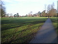
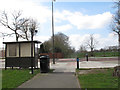
Photos of SE9 2PQ
Area Information
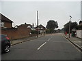
SE9 2PQ is a compact residential cluster covering 12.6 hectares in southeast London, comprising a population of 1,493 people. This postcode sits within the broader Eltham Town and Avery Hill ward of the Royal Borough of Greenwich, an area that balances suburban living with urban access. Residents enjoy a density of 11,826 people per square kilometre, creating a closely knit environment rather than an isolated outskirt. The location benefits from proximity to Eltham town centre and the green spaces of Avery Hill, which lies approximately 8.7 miles east-southeast of Charing Cross. Human activity in this specific locale dates back to the Mesolithic period, evidenced by archaeological finds, while the land itself was recorded in the Domesday Book as 'Eald Ham'. Today, the area retains a distinct character where farms once stood before being developed into modern housing and community estates. Living in SE9 2PQ means being part of a historic setting that has evolved from agricultural roots into a established residential district. You are housebound in an environment that mixes the quiet of neighbourhoods with the practicalities of being near major transport hubs like Falconwood and New Eltham stations.
- Area Type
- Postcode
- Area Size
- 12.6 hectares
- Population
- 1493
- Population Density
- 1691 people/km²
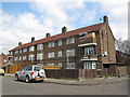
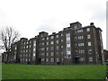
The property market in SE9 2PQ is defined by a strong preference for house ownership. With 89% of residents owning their homes, the area functions as a classic owner-occupied estate rather than a rental hub. The predominant accommodation type is houses, which form the backbone of the local housing stock. This creates a market where stability is the norm, and properties are likely to see long-term occupants rather than frequent turnover. For buyers considering homes in SE9 2PQ, this implies a community invested in maintaining property values and local standards. The high ownership percentage often correlates with careful upkeep and respect for neighbours, creating a predictable environment for investment. While the estate is small, covering only 12.6 hectares, the demand for this type of detached or semi-detached living remains consistent among families seeking space. You are entering a market where the value proposition relies on the scarcity of available properties within this specific suburban pocket. The housing stock caters primarily to those who prioritise roots and permanence over mobility.
House Prices in SE9 2PQ
Showing 4 properties
| Address | Type | Beds | Baths | Last Sale Price | Last Sale Date | |
|---|---|---|---|---|---|---|
| Avery Hill Park Cafe, Cafe, Avery Hill Park, Bexley Road, Eltham, SE9 2PQ | Restaurant | - | - | - | - | |
| London Borough Of Greenwich Parks And Open Spaces, Changing Rooms, Avery Hill Park, Bexley Road, Eltham, SE9 2PQ | Leisure | - | - | - | - | |
| London Borough Of Greenwich Parks And Open Spaces, Public Conveniences, Avery Hill Park, Bexley Road, Eltham, SE9 2PQ | commercial | - | - | - | - | |
| Main Building, Greenwich University Mansion Site, Reinickendorf Avenue, Eltham, SE9 2PQ | commercial | - | - | - | - |
Energy Efficiency in SE9 2PQ
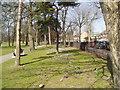
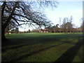
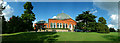
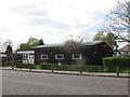
Living in SE9 2PQ offers convenient access to a variety of amenities within practical reach of residents. Retail options include M&S Crownwood Connect BP, Co-op University of, and Co-op Valliers, ensuring you can grab essential items without leaving the immediate vicinity. Transport links are robust, with Falconwood Station, New Eltham, and Eltham train stations nearby for rail travel. If water travel suits your routine, Woolwich Arsenal Pier, Woolwich Ferry North Pier, and Barrier Gardens Pier provide ferry connections. For those seeking speed, King George V Metro station, London City Airport, and Cyprus station offer alternative travel modes. Avery Hill Park is a key landmark nearby, featuring the restored Winter Garden with Britain's largest Canary date palm and the wild flower meadow known as Henley's Field. Eltham Palace serves as another significant local attraction. You will find that shops and parks are integrated into your daily life, reducing the need for long commutes just to run errands.
Amenities
Schools
Families residing in SE9 2PQ have access to a mix of educational institutions within practical reach. Crown Woods College is available as a primary school option for younger children. Further afield, Leigh Stationers' Academy serves as an academy with a 'good' Ofsted rating, providing secondary education for older pupils. This combination of primary and academy provision means you do not need to travel far for your children's education. The presence of a 'good' rated academy like Leigh Stationers' Academy suggests a level of educational quality that families typically expect from their local catchment area. Primary education options remain solid with Crown Woods College ensuring that early years schooling is accessible without long commutes. The availability of these specific schools means that residents are not forced to seek education outside the immediate vicinity. When living in SE9 2PQ, you benefit from a school geography that supports both young learners and teenagers.
| Rank | School | Type | Entry gender | Ages |
|---|
Explore more schools in this area
Go to Schools tabDemographics
The community in SE9 2PQ reflects a mature demographic profile dominated by adults aged between 30 and 64 years. The median age for residents is 47, suggesting a stable population with established families rather than young students or transient workers. Approximately 89% of households own their homes, indicating a highly secure, owner-occupied area where residents have a long-term interest in the locality. Most people live in houses, which aligns with the traditional estate layout found in parts of Eltham and Avery Hill. The predominant ethnic group is White, mirroring the broader demographic trends of the Royal Borough of Greenwich until recent shifts. This high ownership rate contributes to a quiet, settled atmosphere where neighbours often know one another well. The lower density and older population mean that daily life revolves around local routines rather than a fast-paced commuter lifestyle. You will find a neighbourhood where the demographic makeshift feels intentional, driven by a desire for stability and property tenure. The age structure supports local schools and community groups, reinforcing the social fabric of this specific cluster.
Household Size
Accommodation Type
Tenure
Ethnic Group
Religion
Household Composition
Age
Household Deprivation
NS-SEC
Explore more demographic insights in this area
Go to Demographics tabPlanning
Planning Constraints
- Flood RiskPremium
- Ramsar Wetland SitesPremium
- Area of Outstanding Natural BeautyPremium
- Protected Nature ReservePremium
- Protected WoodlandPremium