Area Overview for SE9 2PA
Photos of SE9 2PA


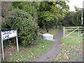


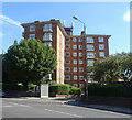


64 photos from this area
Area Information
Key information about the SE9 2PA including its size, population, and administrative classification.
- Area Type
- Postcode
- Area Size
- 5283 m²
- Population
- 1753
- Population Density
- 2399 people/km²
House Prices in SE9 2PA
26
Properties
£329,789
Average Sold Price
£69,000
Lowest Price
£496,134
Highest Price
Showing 26 properties
| Address | Type | Beds | Baths | Last Sale Price | Last Sale Date | |
|---|---|---|---|---|---|---|
| 116 Oakways, Eltham, SE9 2PA | house | - | - | £455,000 | Jul 2025 | |
| 124 Oakways, Eltham, SE9 2PA | Detached | 4 | 1 | £450,000 | Mar 2024 | |
| 121 Oakways, Eltham, SE9 2PA | Semi-detached | 4 | 1 | £496,134 | Dec 2023 | |
| 112 Oakways, Eltham, SE9 2PA | Terraced | 3 | 1 | £460,000 | Nov 2022 | |
| 108 Oakways, Eltham, SE9 2PA | Terraced | 3 | 1 | £385,000 | Jul 2019 | |
| 107 Oakways, Eltham, SE9 2PA | Terraced | 3 | 1 | £370,000 | Dec 2017 | |
| 110 Oakways, Eltham, SE9 2PA | Terraced | 3 | 1 | £380,000 | Nov 2017 | |
| 117 Oakways, Eltham, SE9 2PA | Terraced | 3 | 2 | £420,000 | Sep 2017 | |
| 106 Oakways, Eltham, SE9 2PA | Terraced | 4 | 1 | £300,000 | Oct 2015 | |
| 119 Oakways, Eltham, SE9 2PA | Terraced | 4 | - | £373,500 | Jul 2015 |
Page 1 of 3
Energy Efficiency in SE9 2PA
Amenities
Schools
| Rank | School | Type | Entry gender | Ages |
|---|
Explore more schools in this area
Go to Schools tabDemographics
Household Size
One person
most common
Accommodation Type
Flats
most common
Tenure
53
majority
Ethnic Group
White
most common
Religion
N/A
most common
Household Composition
N/A
most common
Age
47
median
Adults (30-64 years)
most common
Household Deprivation
N/A
with no deprivation
NS-SEC
37
in Lower managerial occupations
Explore more demographic insights in this area
Go to Demographics tabPlanning
Planning Constraints
- Flood RiskPremium
- Ramsar Wetland SitesPremium
- Area of Outstanding Natural BeautyPremium
- Protected Nature ReservePremium
- Protected WoodlandPremium