Area Overview for SE9 2DR
Photos of SE9 2DR
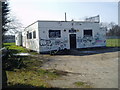
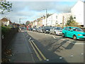
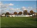

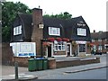
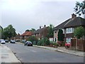
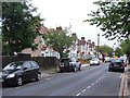
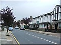

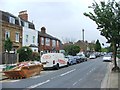
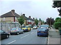
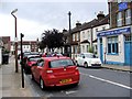
78 photos from this area
Area Information
Key information about the SE9 2DR including its size, population, and administrative classification.
- Area Type
- Postcode
- Area Size
- 5496 m²
- Population
- 1628
- Population Density
- 2346 people/km²
House Prices in SE9 2DR
24
Properties
£243,200
Average Sold Price
£44,000
Lowest Price
£525,000
Highest Price
Showing 24 properties
| Address | Type | Beds | Baths | Last Sale Price | Last Sale Date | |
|---|---|---|---|---|---|---|
| 379A Footscray Road, Eltham, SE9 2DR | Maisonette | 3 | 1 | £525,000 | Jul 2020 | |
| 385A Footscray Road, Eltham, SE9 2DR | Flat | - | - | £480,000 | Jun 2019 | |
| 387A Footscray Road, Eltham, SE9 2DR | Flat | 4 | 1 | £120,000 | Jul 2004 | |
| 391A Footscray Road, Eltham, SE9 2DR | Flat | - | - | £44,000 | Mar 1999 | |
| 377A Footscray Road, Eltham, SE9 2DR | Flat | - | - | £47,000 | Jul 1997 | |
| 399B Footscray Road, Eltham, SE9 2DR | Flat | 2 | - | - | - | |
| 399A Footscray Road, Eltham, SE9 2DR | Flat | - | - | - | - | |
| 397A Footscray Road, Eltham, SE9 2DR | Maisonette | 2 | 1 | - | - | |
| 379B Footscray Road, Eltham, SE9 2DR | Flat | - | - | - | - | |
| 369A Footscray Road, Eltham, SE9 2DR | Flat | - | - | - | - |
Page 1 of 3
Energy Efficiency in SE9 2DR
Amenities
Schools
| Rank | School | Type | Entry gender | Ages |
|---|
Explore more schools in this area
Go to Schools tabDemographics
Household Size
One person
most common
Accommodation Type
Houses
most common
Tenure
76
majority
Ethnic Group
White
most common
Religion
N/A
most common
Household Composition
N/A
most common
Age
47
median
Adults (30-64 years)
most common
Household Deprivation
N/A
with no deprivation
NS-SEC
40
in Lower managerial occupations
Explore more demographic insights in this area
Go to Demographics tabPlanning
Planning Constraints
- Flood RiskPremium
- Ramsar Wetland SitesPremium
- Area of Outstanding Natural BeautyPremium
- Protected Nature ReservePremium
- Protected WoodlandPremium