Area Overview for SE9 2DL
Photos of SE9 2DL
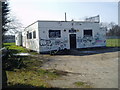
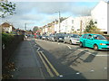
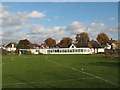

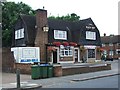
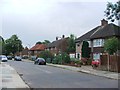
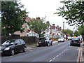
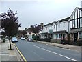

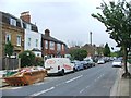
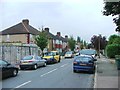
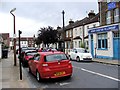
78 photos from this area
Area Information
Key information about the SE9 2DL including its size, population, and administrative classification.
- Area Type
- Postcode
- Area Size
- 4457 m²
- Population
- 1964
- Population Density
- 6092 people/km²
House Prices in SE9 2DL
28
Properties
£341,597
Average Sold Price
£63,000
Lowest Price
£505,000
Highest Price
Showing 28 properties
| Address | Type | Beds | Baths | Last Sale Price | Last Sale Date | |
|---|---|---|---|---|---|---|
| 8 Gaitskell Road, Eltham, SE9 2DL | Terraced | 2 | 1 | £505,000 | Sep 2025 | |
| 13 Gaitskell Road, Eltham, SE9 2DL | Terraced | 2 | 1 | £484,000 | Jun 2025 | |
| 10 Gaitskell Road, Eltham, SE9 2DL | Terraced | 2 | 1 | £471,294 | Feb 2025 | |
| 18 Gaitskell Road, Eltham, SE9 2DL | Terraced | 2 | 1 | £475,000 | Oct 2024 | |
| 20 Gaitskell Road, Eltham, SE9 2DL | Semi-detached | 3 | 1 | £440,000 | Jun 2024 | |
| 1 Gaitskell Road, Eltham, SE9 2DL | Semi-detached | 2 | 1 | £420,000 | May 2024 | |
| 6 Gaitskell Road, Eltham, SE9 2DL | Terraced | 2 | 1 | £475,000 | Jan 2024 | |
| 14 Gaitskell Road, Eltham, SE9 2DL | Terraced | 2 | 1 | £420,000 | Sep 2023 | |
| 3 Gaitskell Road, Eltham, SE9 2DL | Terraced | 2 | 1 | £435,000 | Feb 2021 | |
| 25 Gaitskell Road, Eltham, SE9 2DL | Terraced | 2 | 1 | £370,000 | Jul 2019 |
Page 1 of 3
Energy Efficiency in SE9 2DL
Amenities
Schools
| Rank | School | Type | Entry gender | Ages |
|---|
Explore more schools in this area
Go to Schools tabDemographics
Household Size
Two person
most common
Accommodation Type
Houses
most common
Tenure
63
majority
Ethnic Group
White
most common
Religion
N/A
most common
Household Composition
N/A
most common
Age
47
median
Adults (30-64 years)
most common
Household Deprivation
N/A
with no deprivation
NS-SEC
42
in Lower managerial occupations
Explore more demographic insights in this area
Go to Demographics tabPlanning
Planning Constraints
- Flood RiskPremium
- Ramsar Wetland SitesPremium
- Area of Outstanding Natural BeautyPremium
- Protected Nature ReservePremium
- Protected WoodlandPremium