Area Overview for SE6 1QN
Photos of SE6 1QN

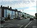
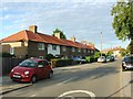
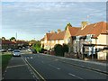
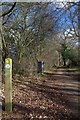
68 photos from this area
Area Information
Key information about the SE6 1QN including its size, population, and administrative classification.
- Area Type
- Postcode
- Area Size
- 7879 m²
- Population
- 1669
- Population Density
- 4822 people/km²
House Prices in SE6 1QN
42
Properties
£212,136
Average Sold Price
£54,000
Lowest Price
£416,500
Highest Price
Showing 42 properties
| Address | Type | Beds | Baths | Last Sale Price | Last Sale Date | |
|---|---|---|---|---|---|---|
| 33 Crutchley Road, London, SE6 1QN | house | 3 | 1 | £416,500 | Feb 2022 | |
| 21 Crutchley Road, London, SE6 1QN | house | 3 | 1 | £330,000 | Feb 2018 | |
| 19 Crutchley Road, London, SE6 1QN | house | - | - | £310,000 | Aug 2015 | |
| 41 Crutchley Road, London, SE6 1QN | house | 3 | - | £189,000 | Jun 2013 | |
| 31 Crutchley Road, London, SE6 1QN | house | 3 | 1 | £217,000 | Apr 2007 | |
| 57 Crutchley Road, London, SE6 1QN | Terraced | - | - | £179,000 | Sep 2006 | |
| 61 Crutchley Road, London, SE6 1QN | house | - | - | £172,000 | Aug 2006 | |
| 49 Crutchley Road, London, SE6 1QN | house | 3 | - | £215,000 | Apr 2006 | |
| 51 Crutchley Road, London, SE6 1QN | house | 3 | - | £175,000 | Oct 2005 | |
| 45 Crutchley Road, London, SE6 1QN | Terraced | - | - | £76,000 | Feb 1999 |
Page 1 of 5
Energy Efficiency in SE6 1QN
Amenities
Schools
| Rank | School | Type | Entry gender | Ages |
|---|
Explore more schools in this area
Go to Schools tabDemographics
Household Size
Family (3-5 people)
most common
Accommodation Type
Houses
most common
Tenure
50
majority
Ethnic Group
White
most common
Religion
N/A
most common
Household Composition
N/A
most common
Age
47
median
Adults (30-64 years)
most common
Household Deprivation
N/A
with no deprivation
NS-SEC
26
in Lower managerial occupations
Explore more demographic insights in this area
Go to Demographics tabPlanning
Planning Constraints
- Flood RiskPremium
- Ramsar Wetland SitesPremium
- Area of Outstanding Natural BeautyPremium
- Protected Nature ReservePremium
- Protected WoodlandPremium