Area Overview for SE5 0EY
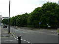
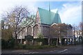
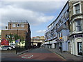
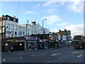
Photos of SE5 0EY


Area Information
The SE5 0EY postcode covers a specific residential cluster comprising 479 square metres. This small area accommodates a population of 2,459 people within a dense urban setting. You are entering a neighbourhood defined by high density rather than sprawling green space. The sheer concentration of residents in such a limited footprint creates a bustling environment where daily life moves quickly. Living in SE5 0EY means navigating an intensely populated space. The population density figure suggests significant proximity between homes and public facilities. Your daily routine will likely involve engaging closely with a tight-knit community structure. Families and professionals share corridors and streets in this compact zone. The area represents a concentrated slice of South London urban living. Expect a lifestyle adapted to high occupancy rates and efficient use of space. The residential cluster format dictates a specific rhythm of neighbourhood interaction. You will find that services and transport nodes are immediately adjacent to your home. This density offers convenience but requires adjustment to a fast-paced local tempo. Understanding the scale of this postcode is essential for moving forward. The compact nature of SE5 0EY defines the entire resident experience here.
- Area Type
- Postcode
- Area Size
- 479 m²
- Population
- 2459
- Population Density
- 8659 people/km²
The property market in SE5 0EY is characterised by a distinct lack of owner-occupiers. Only 29% of residents own their homes, leaving 71% of the population in rented accommodation. This sharp divide suggests a landscape dominated by private sector landlords or larger housing associations. You should approach property searches here with the expectation of viewing rental stock or leasehold flats. Flats represent the predominant accommodation type in this postcode. This aligns perfectly with the small area size of 479 square metres. Large detached houses or semi-detached bungalows are not the norm for SE5 0EY. Instead, the housing stock consists of apartments and upward accommodation designed for density. The high concentration of flats supports the low home ownership statistics. For buyers looking at this small area, the market dynamics favour those willing to navigate rental leases or purchase existing flats. The limited physical space restricts architectural variety to vertical living. You will find homes in SE5 0EY are built for efficiency and shared access. The market reflects a mature sector where investors and tenants outweigh owner-builders. Expect properties to be located within a dense cluster rather than a spreading suburb.
House Prices in SE5 0EY
No properties found in this postcode.
Energy Efficiency in SE5 0EY
Your day-to-day convenience in SE5 0EY is underpinned by a dense network of nearby amenities. Retail options include Tesco Camberwell, Iceland Walworth, and Iceland Camberwell. You will find fresh food and essential shopping items within a short walk. These five retail outlets ensure you do not need to travel far for groceries or household goods. Public transport options are plentiful for your daily commute. Metro stations such as Kennington, Oval, and Borough provide rapid access to central London. Railway stations including Elephant & Castle, Denmark Hill, and Loughborough Junction offer rail connectivity. You also have ferry access via Lambeth Pier, Vauxhall St George Wharf Pier, and Millbank Pier. Three bus routes serve your immediate vicinity through the Green Line and Victoria Coach stations. This mix of transport and retail creates a highly functional lifestyle. You can shop, travel, and access leisure facilities without leaving the local cluster. The presence of multiple pier options suggests river access and potential leisure activities. The variety of metro and rail nodes means short trips become effortless. Living in SE5 0EY offers a lifestyle where practical needs are met by immediate infrastructure.
Amenities
Schools
You have access to St Peter's Church of England Primary School located near SE5 0EY. This primary institution holds a good Ofsted rating. It serves as the only educational establishment listed for this specific cluster. Parents seeking schooling options within SE5 0EY find a single, positively rated primary provider. The absence of secondary or voluntary aided schools in the immediate data set limits choices for older children. Families must look beyond the SE5 0EY boundary for secondary education. St Peter's provides a solid foundation for younger students with its good rating. The proximity of a primary school adds stability to the area for families with young children. This specific school choice defines the educational landscape for this postcode. Living in SE5 0EY gives your primary school-aged children access to a facility with recognised quality standards. The good rating from Ofsted confirms the school's performance meets regulatory expectations. While the range of school types is narrow based on available information, the single option presented is a substantial promise for families. You do not need to travel far for primary education in this area.
| Rank | School | Type | Entry gender | Ages |
|---|
Explore more schools in this area
Go to Schools tabDemographics
The community in SE5 0EY is defined by an older demographic structure with a median age of 47 years. Most residents fall into the adult bracket between 30 and 64 years of age. This age profile suggests a neighbourhood populated by established adults rather than young families or teenagers. Housing tends to be adapted to these older or settled households through specific tenancy arrangements. Only 29% of residents own their homes. This low ownership rate indicates a predominantly rental market where long-term tenants or landlords dominate. You are likely to encounter flats as the primary accommodation type within this postcode. The high density of flats aligns with the limited square mileage of the area. The predominant ethnic group in the area is White, reflecting a specific local composition. Low home ownership rates often correlate with higher population density and transient living situations. The median age of 47 years offers insight into the life stage of your neighbours. Most households consist of working adults who have settled in the area. The demographic data points to a mature, renter-focused community living close together in flats.
Household Size
Accommodation Type
Tenure
Ethnic Group
Religion
Household Composition
Age
Household Deprivation
NS-SEC
Explore more demographic insights in this area
Go to Demographics tabPlanning
Planning Constraints
- Flood RiskPremium
- Ramsar Wetland SitesPremium
- Area of Outstanding Natural BeautyPremium
- Protected Nature ReservePremium
- Protected WoodlandPremium