Area Overview for SE3 9FN
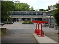
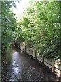
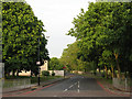
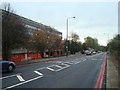
Photos of SE3 9FN
Area Information
Living in SE3 9FN means residing within a compact residential cluster spanning just 1.8 hectares. This small postcode area accommodates 1,301 residents, creating a neighbourhood of 70,780 people per square kilometre. You will find a high-density environment typical of inner London developments where space is at a premium. The population density reflects a built-up area designed for efficiency rather than sprawling gardens. Despite its small footprint, this location commands a prime position with immediate access to significant infrastructure. You are surrounded by a web of transport links that include multiple railway stations, DLR stops, and ferry terminals within practical reach. London City Airport sits nearby, offering direct skies routes for business and leisure. Daily life here revolves around proximity to Kidbrooke town centre and the amenities that cluster around it. The area functions as a dense urban pocket rather than a traditional suburb. You will experience a community shaped by its size and strategic location near Greenwich and across the river. This density ensures that services are never far away, but it also defines the character of homes in SE3 9FN as primarily flat-based living.
- Area Type
- Postcode
- Area Size
- 1.8 hectares
- Population
- 1301
- Population Density
- 4860 people/km²
The property market in SE3 9FN is characterised by a mixed tenure landscape with a significant portion of owner-occupied stock. With 48% of households owning their homes, nearly half the residents have secured ownership in this specific postcode. This is a substantial figure for any urban area of this size and signals that the housing is not exclusively a short-term rental zone. The predominant form of accommodation is flats, which constrains the buyer options compared to suburban properties with gardens. You can expect to search primarily for apartments within this 1.8 hectare cluster. The high population density of 70,780 residents per square kilometre ensures that supply is tight relative to demand. This scarcity often supports property values despite the urban setting. Buyers looking at homes in SE3 9FN must be prepared for vertical living rather than horizontal sprawl. The market reflects a balance between investment properties and genuine family buyers, evidenced by the nearly half ownership stat. Flats dominate the streetscape, meaning you will compete with other investors and those seeking convenience over space. This dynamic creates a competitive environment for purchases in this dense residential pocket.
House Prices in SE3 9FN
Showing 100 properties
Energy Efficiency in SE3 9FN
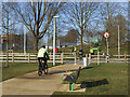
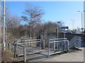
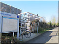
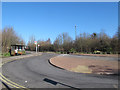
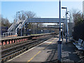
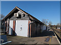
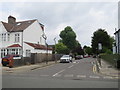
The lifestyle surrounding SE3 9FN is defined by exceptional convenience and a wealth of amenities within practical reach. Residents enjoy immediate access to major retail hubs including Sainsburys Kidbrooke, Tesco Kidbrooke, and Aldi Kidbrooke. These supermarkets provide daily shopping needs without the need for long journeys into central London. Transport options are extensive, with five railway stations listed nearby including Kidbrooke, Lee, and Eltham. You can also access the Docklands Light Railway at Elverson Road or Cutty Sark for Maritime Greenwich. If you prefer water transport, Greenwich Pier, Barrier Gardens Pier, and Royal Wharf Pier offer ferry connections across the river. London City Airport sits close by, facilitating quick air travel for work or holidays. This density of facilities means you rarely need a car to lead a comfortable life. The variety of stations ensures you have flexibility in your commute routing. Dining, leisure, and essential services are clustered just outside this small postcode boundary. Living in SE3 9FN grants you the benefits of a major city's infrastructure without the distances associated with it.
Amenities
Schools
Families living in SE3 9FN have access to specific educational institutions within their immediate vicinity. The nearest school is Holy Family Catholic Primary School, which offers primary education for younger children. This single listed option serves the foundational needs of young families residing in this postcode. You will need to look outside the immediate 1.8 hectare boundary for secondary education options, as only one primary school is listed in the data. The presence of a Catholic primary school indicates religious and faith-based educational provision is available to local families. Since this is the only school listed near SE3 9FN, your choices for later years depend on the broader Bromley or Lewisham catchment areas. The mix is currently limited to primary provision, meaning you cannot rely solely on local school placements for teenagers. Parents must plan ahead regarding admission boundaries for Hilldrop Gardens Secondary and other major institutions outside this immediate neighbourhood. The availability of Holy Family Catholic Primary School provides a solid start for those with young children seeking stable local education.
| Rank | School | Type | Entry gender | Ages |
|---|
Explore more schools in this area
Go to Schools tabDemographics
The community in SE3 9FN has a defined demographic profile distinct from many other London postcodes. The median age stands at 47 years, indicating that adults between 30 and 64 years form the largest age group. This suggests the area appeals strongly to established families and empty nesters rather than young singles or students. Nearly half of all residents, exactly 48%, own their homes outright or with a mortgage. This ownership rate points to a settled population that has invested in the local property market. The remaining half likely comprises renters or future first-time buyers. Accommodation types are dominated by flats, which aligns with the high population density of 70,780 people per square kilometre. You will not find detached houses here; instead, the housing stock consists of apartment blocks and shared residences. The predominant ethnic group is White, though the settlement reflects broader London diversity trends. The age profile means you will encounter a mature neighbourhood where daily life is paced by professional lives and home ownership priorities. Residents here benefit from the stability of a community where long-term tenure is common.
Household Size
Accommodation Type
Tenure
Ethnic Group
Religion
Household Composition
Age
Household Deprivation
NS-SEC
Explore more demographic insights in this area
Go to Demographics tabPlanning
Planning Constraints
- Flood RiskPremium
- Ramsar Wetland SitesPremium
- Area of Outstanding Natural BeautyPremium
- Protected Nature ReservePremium
- Protected WoodlandPremium