Area Overview for SE28 8PN
Photos of SE28 8PN
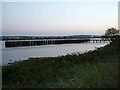
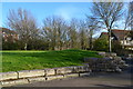
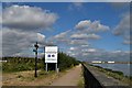
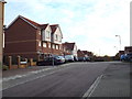
80 photos from this area
Area Information
Key information about the SE28 8PN including its size, population, and administrative classification.
- Area Type
- Postcode
- Area Size
- 1.3 hectares
- Population
- 1677
- Population Density
- 9750 people/km²
House Prices in SE28 8PN
39
Properties
£125,503
Average Sold Price
£36,350
Lowest Price
£290,000
Highest Price
Showing 39 properties
| Address | Type | Beds | Baths | Last Sale Price | Last Sale Date | |
|---|---|---|---|---|---|---|
| 16 Pointer Close, London, SE28 8PN | Flat | - | - | £190,000 | Aug 2024 | |
| 23 Pointer Close, London, SE28 8PN | Flat | 2 | 1 | £226,500 | Jul 2024 | |
| 26 Pointer Close, London, SE28 8PN | Flat | - | - | £120,000 | Aug 2022 | |
| 6 Pointer Close, London, SE28 8PN | Maisonette | 2 | 1 | £175,000 | Jan 2019 | |
| 28 Pointer Close, London, SE28 8PN | Flat | - | - | £240,000 | Aug 2018 | |
| 2 Pointer Close, London, SE28 8PN | Terraced | 3 | 1 | £290,000 | Sep 2016 | |
| 17 Pointer Close, London, SE28 8PN | Flat | - | - | £199,000 | Feb 2016 | |
| 29 Pointer Close, London, SE28 8PN | Flat | 2 | - | £148,750 | Dec 2014 | |
| 8 Pointer Close, London, SE28 8PN | Flat | 2 | - | £140,000 | May 2014 | |
| 32 Pointer Close, London, SE28 8PN | Flat | - | - | £91,500 | Mar 2014 |
Page 1 of 4
Energy Efficiency in SE28 8PN
Amenities
Schools
| Rank | School | Type | Entry gender | Ages |
|---|
Explore more schools in this area
Go to Schools tabDemographics
Household Size
Family (3-5 people)
most common
Accommodation Type
Houses
most common
Tenure
44
majority
Ethnic Group
black_total
most common
Religion
N/A
most common
Household Composition
N/A
most common
Age
47
median
Adults (30-64 years)
most common
Household Deprivation
N/A
with no deprivation
NS-SEC
25
in Lower managerial occupations
Explore more demographic insights in this area
Go to Demographics tabPlanning
Planning Constraints
- Flood RiskPremium
- Ramsar Wetland SitesPremium
- Area of Outstanding Natural BeautyPremium
- Protected Nature ReservePremium
- Protected WoodlandPremium