Area Overview for SE26 5JQ
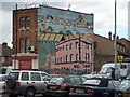
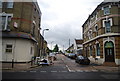
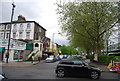
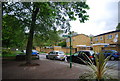
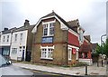
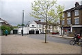
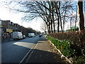
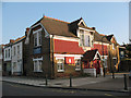
Photos of SE26 5JQ
Area Information
Living in SE26 5JQ means residing within a specific postcode area that covers a small residential cluster of just 6100 square metres. This compact space supports 1848 residents, creating a tightly knit environment where daily interactions are frequent. The location sits within the Penge & Cator Ward of the London Borough of Bromley, placing you approximately 3.7 miles north east of Bromley town centre. Although the area is small in footprint, it benefits from historic significance dating back to when Penge was once a small hamlet attached to the manor of Battersea. The suburb became independent in 1888 and later merged into the local borough in 1965. Your daily life here is defined by practical convenience and proximity to key landmarks like the Crooked Billet, one of the oldest public houses in Penge. The history of this neighbourhood includes years of Victorian expansion as a fashionable suburb near the Crystal Palace. Today, the area serves as a residential enclave where the population density is high compared to the national average. You are not buying into a sprawling development but rather a concentrated cluster that maximises access to local services while maintaining a sense of established community heritage rooted in the historic Cator estates.
- Area Type
- Postcode
- Area Size
- 6100 m²
- Population
- 1848
- Population Density
- 9984 people/km²
The property market in SE26 5JQ is defined by a clear distinction between owner-occupiers and renters. A precise 60% of the population owns their homes, signalling that the majority of the housing stock is privately owned rather than rented. This high ownership rate typically indicates a stable market where properties change hands through purchase rather than lease agreements. Because the data specifies that Houses are the predominant accommodation type, most listings you will encounter in this small cluster will be standalone properties rather than large blocks of flats. For buyers looking at this specific postcode, the high ownership percentage suggests that competition exists primarily among purchasing families or empty nesters. The fact that only 40% of residents rent implies that this is not a student housing hub or a temporary commuter zone. The housing stock consists largely of traditional houses, consistent with the Victorian expansion that characterises the wider Penge area. When viewing homes in SE26 5JQ, you are entering a market dominated by permanent residents who have secured their foothold in the area. This concentration of owner-occupiers often correlates with higher average property values and a slower, more deliberate approach to transactions.
House Prices in SE26 5JQ
Showing 35 properties
| Address | Type | Beds | Baths | Last Sale Price | Last Sale Date | |
|---|---|---|---|---|---|---|
| 156 Venner Road, Sydenham, London, SE26 5JQ | Semi-detached | 5 | 2 | £1,170,000 | Oct 2024 | |
| 154 Venner Road, Sydenham, London, SE26 5JQ | Semi-detached | 5 | 3 | £1,100,000 | Aug 2024 | |
| 172 Venner Road, Sydenham, London, SE26 5JQ | house | - | - | £942,000 | Sep 2020 | |
| 158 Venner Road, Sydenham, London, SE26 5JQ | house | 5 | - | £950,000 | Aug 2019 | |
| 170 Venner Road, Sydenham, London, SE26 5JQ | Terraced | 5 | 2 | £710,000 | Dec 2013 | |
| 150 Venner Road, Sydenham, London, SE26 5JQ | Flat | 1 | 1 | £185,000 | Aug 1999 | |
| 162 Venner Road, Sydenham, London, SE26 5JQ | house | 4 | 2 | £112,000 | Feb 1997 | |
| Flat 1, 174 Venner Road, Sydenham, London, SE26 5JQ | Flat | 2 | 1 | - | - | |
| 178A Venner Road, Sydenham, London, SE26 5JQ | Flat | 2 | 1 | - | - | |
| Ground Floor, 178 Venner Road, Sydenham, London, SE26 5JQ | Flat | 2 | 1 | - | - |
Energy Efficiency in SE26 5JQ
Your lifestyle in SE26 5JQ benefits from immediate access to five distinct railway stations and five tram stops. You can easily reach Penge East or Sydenham Station for broader travel needs. Your grocery shopping is settled with five local retailers, including Tesco Penge, Tesco Sydenham, and Iceland Penge. These venues provide the essentials without requiring a long journey. You also have access to five ferry terminals, such as Greenwich Pier, if you prefer water-based travel options to Southeast London. Beyond utilities and transit, the area offers deep historical charm. The Crooked Billet pub dates back at least to 1601 and serves as a landmark near the postcode. Victorian almshouses line Beckenham Road, featuring the Free Watermen and Lightermen's Almshouses from 1840 and Queen Adelaide Almshouses from 1848. St John's Cottages on Maple Road offers another example of the area's preservation. Living in this cluster means you are walking distance to significant pieces of local history while enjoying the convenience of modern amenities. The proximity of these specific venues guarantees that daily errands are simple and culturally rich environments are always nearby.
Amenities
Schools
| Rank | School | Type | Entry gender | Ages |
|---|
Explore more schools in this area
Go to Schools tabDemographics
The community in SE26 5JQ is predominantly composed of adults aged between 30 and 64 years. Statistics show that the median age for this population is 47, indicating a mature demographic focused on stability rather than rapid transient movement. This age profile aligns with a region where 60% of residents own their homes outright. Such a high level of home ownership suggests that the majority of individuals have settled down and invested in this postcode area for the long term. Houses remain the primary form of accommodation, confirming that the architectural stock caters to families or individuals seeking traditional living spaces rather than flats or apartments. The predominant ethnic group is White, which reflects the broader historical settlement patterns of the locality. Because adult residents make up the most common age range, the community avoids the volatility often seen in student-heavy zones. You can expect neighbours who are likely retirees or established professionals. The demographic data paints a picture of a quieter, more settled neighbourhood where long-term residents form the backbone of local social structures.
Household Size
Accommodation Type
Tenure
Ethnic Group
Religion
Household Composition
Age
Household Deprivation
NS-SEC
Explore more demographic insights in this area
Go to Demographics tabPlanning
Planning Constraints
- Flood RiskPremium
- Ramsar Wetland SitesPremium
- Area of Outstanding Natural BeautyPremium
- Protected Nature ReservePremium
- Protected WoodlandPremium