Area Overview for SE24 9HD
Photos of SE24 9HD
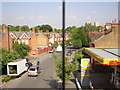
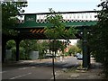
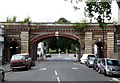

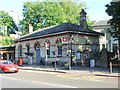
100 photos from this area
Area Information
Key information about the SE24 9HD including its size, population, and administrative classification.
- Area Type
- Postcode
- Area Size
- 3.1 hectares
- Population
- 1706
- Population Density
- 4821 people/km²
House Prices in SE24 9HD
20
Properties
£1,524,282
Average Sold Price
£325,000
Lowest Price
£3,400,000
Highest Price
Showing 20 properties
| Address | Type | Beds | Baths | Last Sale Price | Last Sale Date | |
|---|---|---|---|---|---|---|
| 93 Burbage Road, London, SE24 9HD | house | - | - | £2,250,000 | Aug 2024 | |
| 118 Burbage Road, London, SE24 9HD | house | 5 | 2 | £3,250,000 | Jul 2023 | |
| 99 Burbage Road, London, SE24 9HD | house | - | - | £2,330,000 | Nov 2021 | |
| 116 Burbage Road, London, SE24 9HD | house | - | - | £1,440,000 | May 2019 | |
| 95 Burbage Road, London, SE24 9HD | house | 5 | - | £2,160,000 | Nov 2017 | |
| 97 Burbage Road, London, SE24 9HD | house | 5 | 4 | £1,980,000 | Mar 2016 | |
| 105 Burbage Road, London, SE24 9HD | Detached | 6 | - | £3,400,000 | Aug 2015 | |
| 101 Burbage Road, London, SE24 9HD | Terraced | - | - | £1,075,000 | Jul 2006 | |
| 103 Burbage Road, London, SE24 9HD | Semi-detached | 5 | 4 | £900,000 | Jul 2005 | |
| 110 Burbage Road, London, SE24 9HD | Semi-detached | - | - | £570,000 | Oct 2001 |
Page 1 of 2
Energy Efficiency in SE24 9HD
Amenities
Schools
| Rank | School | Type | Entry gender | Ages |
|---|
Explore more schools in this area
Go to Schools tabDemographics
Household Size
Family (3-5 people)
most common
Accommodation Type
Houses
most common
Tenure
73
majority
Ethnic Group
White
most common
Religion
N/A
most common
Household Composition
N/A
most common
Age
47
median
Adults (30-64 years)
most common
Household Deprivation
N/A
with no deprivation
NS-SEC
62
in Lower managerial occupations
Explore more demographic insights in this area
Go to Demographics tabPlanning
Planning Constraints
- Flood RiskPremium
- Ramsar Wetland SitesPremium
- Area of Outstanding Natural BeautyPremium
- Protected Nature ReservePremium
- Protected WoodlandPremium