Area Overview for SE24 9HE
Photos of SE24 9HE
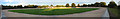
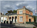
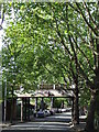

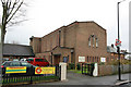


100 photos from this area
Area Information
Key information about the SE24 9HE including its size, population, and administrative classification.
- Area Type
- Postcode
- Area Size
- 6.8 hectares
- Population
- 1706
- Population Density
- 4821 people/km²
House Prices in SE24 9HE
36
Properties
£1,408,600
Average Sold Price
£195,800
Lowest Price
£3,250,000
Highest Price
Showing 36 properties
| Address | Type | Beds | Baths | Last Sale Price | Last Sale Date | |
|---|---|---|---|---|---|---|
| 94 Burbage Road, London, SE24 9HE | house | - | - | £3,250,000 | Feb 2025 | |
| 56 Burbage Road, London, SE24 9HE | Detached | 4 | 3 | £2,425,000 | Oct 2023 | |
| 98 Burbage Road, London, SE24 9HE | Retail | 5 | 3 | £2,300,000 | Sep 2022 | |
| 76 Burbage Road, London, SE24 9HE | house | - | - | £2,735,000 | Aug 2021 | |
| 92 Burbage Road, London, SE24 9HE | house | - | - | £2,400,000 | Jul 2016 | |
| 100 Burbage Road, London, SE24 9HE | Semi-detached | 5 | 3 | £2,900,000 | Jul 2015 | |
| 78 Burbage Road, London, SE24 9HE | Semi-detached | 5 | 3 | £1,975,000 | Mar 2014 | |
| 58 Burbage Road, London, SE24 9HE | Detached | - | - | £1,520,000 | Sep 2007 | |
| 74 Burbage Road, London, SE24 9HE | Terraced | - | - | £1,050,000 | Jun 2006 | |
| 68 Burbage Road, London, SE24 9HE | house | - | - | £875,000 | Aug 2005 |
Page 1 of 4
Energy Efficiency in SE24 9HE
Amenities
Schools
| Rank | School | Type | Entry gender | Ages |
|---|
Explore more schools in this area
Go to Schools tabDemographics
Household Size
Family (3-5 people)
most common
Accommodation Type
Houses
most common
Tenure
73
majority
Ethnic Group
White
most common
Religion
N/A
most common
Household Composition
N/A
most common
Age
47
median
Adults (30-64 years)
most common
Household Deprivation
N/A
with no deprivation
NS-SEC
62
in Lower managerial occupations
Explore more demographic insights in this area
Go to Demographics tabPlanning
Planning Constraints
- Flood RiskPremium
- Ramsar Wetland SitesPremium
- Area of Outstanding Natural BeautyPremium
- Protected Nature ReservePremium
- Protected WoodlandPremium