Area Overview for SE22 9HJ
Photos of SE22 9HJ
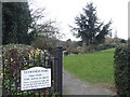
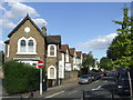
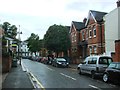
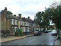
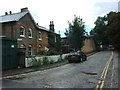
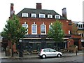
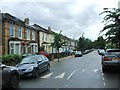
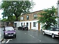
95 photos from this area
Area Information
Key information about the SE22 9HJ including its size, population, and administrative classification.
- Area Type
- Postcode
- Area Size
- 4393 m²
- Population
- 1655
- Population Density
- 12538 people/km²
House Prices in SE22 9HJ
27
Properties
£732,089
Average Sold Price
£58,000
Lowest Price
£1,280,000
Highest Price
Showing 27 properties
| Address | Type | Beds | Baths | Last Sale Price | Last Sale Date | |
|---|---|---|---|---|---|---|
| 34 Archdale Road, London, SE22 9HJ | Terraced | 3 | 1 | £1,085,000 | Dec 2025 | |
| 12 Archdale Road, London, SE22 9HJ | Terraced | 4 | 2 | £1,240,000 | Apr 2025 | |
| 46 Archdale Road, London, SE22 9HJ | Terraced | 2 | 2 | £664,000 | Aug 2024 | |
| 20 Archdale Road, London, SE22 9HJ | Detached | 4 | 3 | £1,280,000 | Jul 2024 | |
| 18 Archdale Road, London, SE22 9HJ | Detached | 2 | 1 | £1,125,000 | Aug 2023 | |
| 2 Archdale Road, London, SE22 9HJ | Terraced | 3 | - | £952,000 | Aug 2021 | |
| 38 Archdale Road, London, SE22 9HJ | house | - | - | £825,000 | Dec 2020 | |
| 4 Archdale Road, London, SE22 9HJ | Terraced | 3 | 3 | £940,000 | Nov 2017 | |
| 8 Archdale Road, London, SE22 9HJ | Terraced | 4 | 1 | £482,500 | May 2012 | |
| 30 Archdale Road, London, SE22 9HJ | house | 2 | - | £370,000 | Sep 2010 |
Page 1 of 3
Energy Efficiency in SE22 9HJ
Amenities
Schools
| Rank | School | Type | Entry gender | Ages |
|---|
Explore more schools in this area
Go to Schools tabDemographics
Household Size
Family (3-5 people)
most common
Accommodation Type
Houses
most common
Tenure
54
majority
Ethnic Group
White
most common
Religion
N/A
most common
Household Composition
N/A
most common
Age
47
median
Adults (30-64 years)
most common
Household Deprivation
N/A
with no deprivation
NS-SEC
58
in Lower managerial occupations
Explore more demographic insights in this area
Go to Demographics tabPlanning
Planning Constraints
- Flood RiskPremium
- Ramsar Wetland SitesPremium
- Area of Outstanding Natural BeautyPremium
- Protected Nature ReservePremium
- Protected WoodlandPremium