Area Overview for SE22 8AL
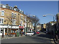
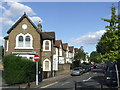
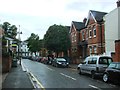
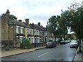
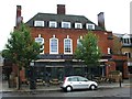
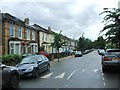
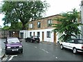
Photos of SE22 8AL


Area Information
Living in SE22 8AL means occupying a specific postcode area that covers a small residential cluster. This postcode holds a total population of 1,587 people across a land area of 3,304 square metres. Such a compact footprint creates a tightly knit environment where daily life moves quickly between homes. You are part of a neighbourhood defined by high density and focused convenience rather than sprawling suburbs. The median age here is 47, suggesting a community settled into family life or later career stages. Residents expect proximity to all essential services within a short walk or a quick train ride. This area functions as a concentrated slice of London where urban density meets practical accessibility. You will not find extensive green belts or large industrial zones dominating the immediate surroundings. Instead, the focus is on efficient living with easy access to national rail networks and major thoroughfares. The small population relative to the space indicates a planned cluster rather than organic sprawl. Every day involves navigating a layout designed for immediate proximity to employment hubs and leisure spots. Understanding this scale helps you appreciate the trade-offs between privacy and community connection in this specific SE22 address.
- Area Type
- Postcode
- Area Size
- 3304 m²
- Population
- 1587
- Population Density
- 25433 people/km²
The property market in SE22 8AL is defined by a specific housing stock that centres on flats. Flats are the predominant accommodation type, meaning you will find most homes in SE22 8AL are designed for multi-level or high-rise living rather than detached semi-detached houses. This structural preference reflects the high density required in such a small residential cluster. Only 20% of residents own their homes, which signals a market where rental transactions dominate over owner-occupied sales. For buyers looking at this postcode, the opportunity to purchase equity might be more limited compared to neighbouring areas with higher ownership rates. This data implies a high demand for rental inventory among the large 80% of the population who do not own their properties. You should expect competition from landlords who maintain these units alongside a steady flow of new tenants. The small total population of 1,587 impacts property volume, suggesting fewer individual stock options within the exact SE22 8AL boundary compared to larger districts. However, the broader accessibility to surrounding zones ensures that homes here remain attractive to commuters. If you are considering purchasing a home in this area, focus on flats located in buildings that cater to the established adult demographic. The market here operates on the logic of maximising space usage through vertical living solutions typical of dense London postcodes.
House Prices in SE22 8AL
Showing 51 properties
Energy Efficiency in SE22 8AL
Living in SE22 8AL offers immediate access to a diverse range of amenities that serve the local population effectively. Within practical reach, you can shop at notable retailers such as M&S East Dulwich SF, Sainsburys Dulwich, and Co-op Dulwich. These grocery and high-street options ensure you can run weekly errands without travelling far. Beyond retail, rail connectivity places you near Denmark Hill Station, Peckham Rye Station, and North Dulwich. These stops provide direct links to wider London zones, making commuting straightforward. You also have metro options via Oval, Stockwell Station, and Kennington Station, offering additional flexibility for travel plans. For those who travel by water, Vauxhall St George Wharf Pier, Millbank Pier, and Lambeth Pier provide ferry routes to other parts of the capital. Bus services from Green Line Coach Station, Victoria Coach Station, and the arrivals hall at Victoria ensure road connectivity remains strong. The presence of five retail venues, five rail stations, five metro stations, five ferry points, and three bus nodes creates a layered transport and shopping network. This density means you do not rely on a single mode of transport to access the city centre or suburbs. Your daily routine involves easy access to everything from fresh food to public transit hubs.
Amenities
Schools
| Rank | School | Type | Entry gender | Ages |
|---|
Explore more schools in this area
Go to Schools tabDemographics
The community in SE22 8AL reflects a mature demographic profile with a median age of 47 years. Adults between the ages of 30 and 64 constitute the most common age range, which shapes the social dynamics and local demand for amenities. Only 20% of residents own their homes, indicating that the majority of the population lives in rental accommodation. This statistic fundamentally alters the nature of the neighbourhood's stability and investment potential. Flats represent the predominant accommodation type, aligning with the high density of the SE22 8AL postcode. Ethnically, the black_total group forms the predominant ethnic demographic in this cluster. This diversity contributes to a multi-cultural environment where you might encounter a variety of languages and traditions on a daily basis. Given the age profile and accommodation mix, retirees and young professionals coexist within the same housing stock. The low home ownership rate of 20% suggests a market heavily influenced by tenants seeking flexible living arrangements in flats. When considering living in SE22 8AL, you are entering an area where long-term ownership is less common than renting. The population density reaches an extraordinary 480,348 people per square kilometre, confirming the intense urban character of this postcode.
Household Size
Accommodation Type
Tenure
Ethnic Group
Religion
Household Composition
Age
Household Deprivation
NS-SEC
Explore more demographic insights in this area
Go to Demographics tabPlanning
Planning Constraints
- Flood RiskPremium
- Ramsar Wetland SitesPremium
- Area of Outstanding Natural BeautyPremium
- Protected Nature ReservePremium
- Protected WoodlandPremium