Area Overview for SE20 7NF
Photos of SE20 7NF
Area Information
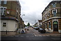
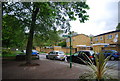
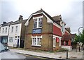
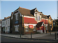
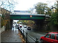
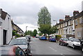
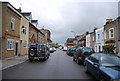
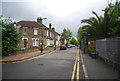
Living in SE20 7NF means residing within a specific residential cluster in the London Borough of Bromley. This postcode covers 1,336 square metres and holds a population of 1,696 people. The area sits approximately 3.5 miles west of Bromley town centre and forms part of the historic Penge and Cator estates. Originally a small hamlet attached to the manor of Battersea, Penge became an independent urban district in Kent in 1900 before merging into the London Borough in 1965. Victorian expansion turned it into a fashionable suburb near the Crystal Palace, while the road itself once facilitated numerous bus routes terminating at the Crooked Billet. You are purchasing into a community with deep historical roots. The location has remained largely focused on housing over the years, with the London and Croydon Railway running nearby since 1839. Your daily life in SE20 7NF will be defined by proximity to these historic landmarks and modern transport links. The area functions as a residential hub where past and present converge. You gain access to a neighbourhood that has evolved from a rural hamlet into a settled suburban enclave. The small size of the postcode area suggests a tight-knit environment, yet it remains well-connected via rail and tram networks.
- Area Type
- Postcode
- Area Size
- 1336 m²
- Population
- 1696
- Population Density
- 10554 people/km²
The property market in SE20 7NF is characterised by headroom for owner-occupiers rather than a bustling lettings scene. With 54% home ownership, the majority of the 1,696 residents hold the title deeds to their properties. This suggests you will see houses grouped in clusters rather than rows of purpose-built rental blocks. Living in this area offers security that comes with an established tenure rather than the uncertainty of a private landlord. The accommodation type is strictly houses, meaning you purchase a permanent brick-and-mortar asset rather than a leasehold apartment. You should anticipate a competition focused on value retention rather than speculative flipping. The small population size of 1,696 people limits the total volume of transactions, which often leads to differentiated pricing between specific streets. When considering homes in SE20 7NF, you are buying into a legacy market where the Cator family history influences the style of architecture. Thomas Crapper, the famous plumber, once retired to 12 Thornsett Road in this locality. Your potential purchase may be near historic sites like the Free Watermen and Lightermen's Almshouses or Queen Adelaide Almshouses on street fronts. The 54% ownership rate assures you that demand is driven by local buyers seeking stability in a postcode covering just 1,336 square metres.
House Prices in SE20 7NF
Showing 12 properties
Energy Efficiency in SE20 7NF
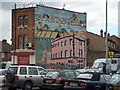
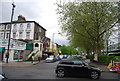
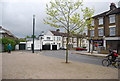
Your daily life in SE20 7NF is supported by five notable retail outlets. You can shop locally at Iceland Penge, Sainsburys Penge, and Tesco Penge for weekly provisions. These supermarkets are situated near the main thoroughfares of the Penge and Cator estates. Five ferry piers, including Greenland Surrey Quays Pier, provide access to the River Thames if you enjoy water-based activities. The historic core of the area features the Crooked Billet, the oldest public house in Penge dating back to at least 1601. You can enjoy a pint in this venue after visiting Victorian almshouses like the Free Watermen and Lightermen's Almshouses on Beckenham Road. Penge High Street, formerly Penge New Road, features historic development that adds character to your street view. Bus routes like the number 109 and 609 traditionally terminated at the Crooked Billet from 1914, and these paths remain active today. The area incorporates five tram stops such as the Avenue Road Tram Stop for short trips across the borough. While the postcode covers only 1,336 square metres, the network of amenities feels extensive due to its integration with the wider suburb. You spend less time commuting to essentials because they are located within walking distance of the residential clusters. The presence of shopping centres and historic pubs ensures your evenings are vibrant without needing to leave the London Borough of Bromley.
Amenities
Schools
| Rank | School | Type | Entry gender | Ages |
|---|
Explore more schools in this area
Go to Schools tabDemographics
The community in SE20 7NF reflects an established residential pattern. Half of the population, or 54%, owns their homes outright. This indicates a stable area where landlords photograph properties for sale rather than tenants signing short-term leases. The 1,696 residents live primarily in houses, meaning you are unlikely to find the high-rise apartments found in central London districts. Adults between the ages of 30 and 64 dominate the demographic profile. The median age sits at 47 years, confirming that this is a mature neighbourhood with an older, settled population. Most residents identify as White, consistent with the historic character of the Cator estates. You will find few young families with small children, as the median age suggests most households are empty nesters or active professionals in mid-life. The low density of households relative to the land size points to single-family living rather than shared flats. This demographic composition means noise levels are likely lower than in student pockets of London. When you look at the 1336 square metres covered by this postcode, you are seeing a deliberate spread of people across established plots. The absence of young adults under 30 suggests a quiet atmosphere during evening hours.
Household Size
Accommodation Type
Tenure
Ethnic Group
Religion
Household Composition
Age
Household Deprivation
NS-SEC
Explore more demographic insights in this area
Go to Demographics tabPlanning
Planning Constraints
- Flood RiskPremium
- Ramsar Wetland SitesPremium
- Area of Outstanding Natural BeautyPremium
- Protected Nature ReservePremium
- Protected WoodlandPremium